
91 - 100 of 115 Selling leads
|
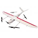
VTOL Fixed Wing Drone Application for Mapping & Survey GS-S300 is a pure electric VTOL fixed wing drone, with a simple and smooth appearance design, ...
2025-07-25 11:54:13
|
|
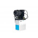
gAirHawk GS-100M+ LIDAR SCANNING SYSTEM Drone LiDAR Scanning System Mounted on DJI M600 Pro Application for Mapping and Survey gAirHawk GS-100M+ is a ...
2025-07-25 11:54:03
|
|
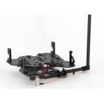
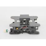
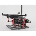
Mounting Kits for DJI M210, M300, M600 Pro and other brands. DJI drones are good application for survey & mapping, especially for DJI M210, M300 and ...
2025-07-25 11:53:59
|
|
gAirHawk GS-2000R LIDAR SCANNING SYSTEM Long Range LiDAR Scanning System with Riegl Laser Sensor gAirHawk GS-2000R is a kind of long range, compact ...
2025-07-25 11:53:59
|
|
Mounting Kits for DJI M210, M300, M600 Pro and other brands. DJI drones are good application for survey & mapping, especially for DJI M210, M300 and ...
2025-07-25 11:53:58
|
|
Mounting Kits for DJI M210, M350/300, M600 Pro and other brands. DJI drones are good application for survey & mapping, especially for DJI M210, M300 ...
2025-07-25 11:53:58
|
|
GGPoS Software – High-Precision GNSS Positioning and Velocity Solution GGPoS is a high-precision GNSS data processing software system designed for GPS...
2025-07-25 11:53:58
|
|
GGPoS – Precision GNSS Data Processing for Positioning & Velocity GGPoS is a high-performance GNSS post-processing software developed by Geosun ...
2025-07-25 11:53:57
|
|
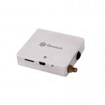
Photography Surveying PPK Solution Aerial GNSS Receiver Features of PPK Solution Lightweight and flexible aviation GNSS positioning receiver GGPos ...
2025-07-25 11:53:51
|
|
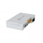
GPS BDS GLONASS GNSS INS System For Positioning And Altitude AGS 300 GNSS INS System adds a high-precision inertial navigation (IMU) module, no matter ...
2025-07-25 11:53:51
|