
31 - 40 of 115 Selling leads

|
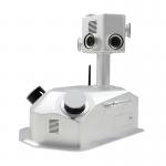
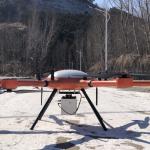
Geosun GAirHawk Series GS-2000N LiDAR Scanning System High Accuracy Colored Point Cloud Long Detection Airborne Mapping Geosun gAirHawk Series GS...
2025-08-04 00:10:34
|

|
Aerial Mapping GS-100V UAV LiDAR Scanning System 360 Degree Fov Laser Sensor Colored Point Cloud Free Software Geosun gAirHawk LiDAR Scanning System ...
2025-08-04 00:10:34
|

|
Terrain Mapping Aerial Surveying Geosun UAV LiDAR GS-130X High Precision Cost-Effective Cost Highly Integration Geosun gAirHawk Series GS-130X UAV ...
2025-08-04 00:10:34
|
|
gCollector-M302 Road Information Collection LiDAR Scanning System The gCollector-M302 Road Information Collection system is a mobile real scense ...
2025-08-04 00:10:34
|
|
gCollector-M502 Road Information Collection LiDAR Scanning System The gCollector-M502 Road Information Collection system is a mobile real scense ...
2025-08-04 00:10:34
|

|
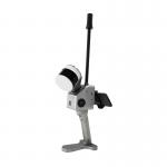
Geosun GFireEye Series GS-100G LiDAR Scanning System HESAI XT16 Slam Algorithms Under Ground Mapping 3D Data Collection Geosun gFireEye Series GS-100G ...
2025-08-04 00:10:34
|
|
Geosun GFireEye Series GS-100G SLAM LiDAR Scanning System HESAI XT16 Slam Algorithms Under Ground Mapping 3D Data Collection Geosun gFireEye Series GS...
2025-08-04 00:10:34
|

|
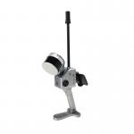
Handheld LiDAR Scanning System Mobile Mapping Solution Geosun GS-100G Building 3D Data Collection Geosun gFireEye Series GS-100G Handheld LiDAR ...
2025-08-04 00:10:34
|
|
Geosun GFireEye Series GS-130G SLAM LiDAR HESAI XT32 Slam Algorithms Indoor Outdoor Mapping 3D Data Collection Geosun gFireEye Series GS-130G SLAM ...
2025-08-04 00:10:34
|
|
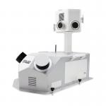
Terrain Mapping Long Range Detection LiDAR Scanning Support VTOL Airborne High Accuracy DEM Geosun gAirHawk Series GS-2000N UAV LiDAR Scanning System ...
2025-08-04 00:10:34
|