
41 - 50 of 115 Selling leads
|
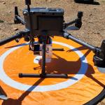
Land Mapping Drone LiDAR Mapping 3D Scanning Accuractely Capture Demonstration In Australia Geosun gAirHawk Series Drone LiDAR Scanning System GS-130X ...
2025-08-04 00:10:34
|
|
Land Mapping Drone Payload UAV LiDAR Surveying Geosun Partner In Indian Multi-Rotor Support High Precision Geosun gAirHawk Series GS-260X uav LiDAR ...
2025-08-04 00:10:34
|
|
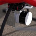
UAV Lidar Scanning Systems Geosun GS-260X HESAI XT Laser Sensor 1.6 k㎡ For 3D Scanning LiDAR Scanning System with HESAI XT Laser Sensor gAirHawk GS...
2025-08-04 00:10:34
|
|
3D Tower Mapping Modeling UAV LiDAR Scanning System Geosun GS-130X Geosun gAirHawk Series GS-130X UAV LiDAR Scanning System UAV LiDAR Scanning System ...
2025-08-04 00:10:34
|
|
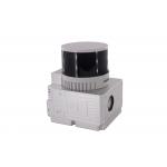
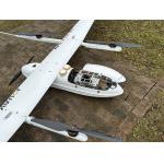
UAV LiDAR Scanning System GS 100C+ Livox Avia Topographic Surveying And Mapping Solution Drone LiDAR Scanning System Mounted on DJI M300 , with Livox ...
2025-08-04 00:10:34
|
|
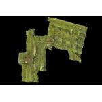
Forestry Surveying Drone LiDAR Geosun GS-260X Aerial Mapping Solution Geosun gAirHawk Series GS-260X Drone LiDAR Scanning System gAirHawk GS-260X is a ...
2025-08-04 00:10:34
|
|
Land Surveying Vtol LiDAR Long Detection Geosun gAirHawk GS-2000N Geosun gAirHawk Series uav LiDAR Scanning System GS-2000N UAV LiDAR Scanning System ...
2025-08-04 00:10:34
|
|
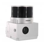
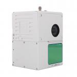
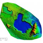
Reservoir Mapping Drone LiDAR Scanning System DEM Output GS-130X HESAI XT32 Geosun gAirHawk Series GS-130X Drone LiDAR Scanning System UAV LiDAR ...
2025-08-04 00:10:34
|

|
Terrain Mapping Drone LiDAR GS-260X Colored Point Cloud High Accuracy Affordable Cost Geosun gAirHawk GS-260X UAV LiDAR Scanning System gAirHawk GS...
2025-08-04 00:10:34
|
|
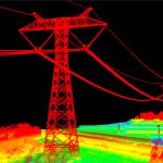
500kv Power Line Inspection Drone LiDAR Scanning System Geosun GS-260X PPK RTK Processing Geosun gAirHawk Series GS-260X Drone LiDAR Scanning System ...
2025-08-04 00:10:34
|