Geosun GFireEye Series GS-100G LiDAR Scanning System HESAI XT16
Slam Algorithms Under Ground Mapping 3D Data Collection
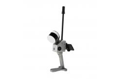
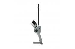
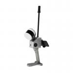
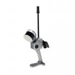
Geosun gFireEye Series GS-100G LiDAR Scanning System
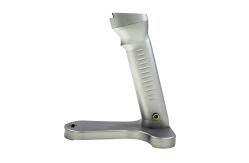
GS-100G is a kind of handheld LiDAR scanning system independently
developed by Geosun company.It adopts a simple design with a small
body, so as to be light to carry, easy to operate and flexible to
install.With a variety of sensors, it can quickly capture a wide
range of scene data, support multi-platform and multi-mode
operation, and combine GNSS, INS, LiDAR and SLAM algorithms to
achieve seamless survey of indoor and outdoor scenes. SLAM Serial Solution.pdf
Specification of SLAM LiDAR Scanning System GS-100G
| System Parameter |
| Point Cloud Accuracy | 5cm@100m without control point |
| Weight | 2.15kg(with battery) |
| Battery Parameter | 11600 mAh |
| Storage | Build-in Flash memory 128GB,
Support microSD 256GB. |
| Voltage Range | 12V-18V |
| Working Temperature | -20℃-55℃ |
| Carrying Platform | Hand-held and Vehicle |
| System Consumption | 25W |
| POS Unit |
| Model | gSpin 210 |
| Update Frequency | 200Hz |
| GNSS Signal Type | GPS L1/L2/L5, GLONASS L1/L2
BDS B1C/B1/B2/B2a/B2b/B3
GALELEO E1/E5b/E5a |
| Position Accuracy | Horizonal 0.02m Elevation 0.03m |
| Pitch Accuracy | 0.015° |
| Roll Accuracy | 0.015° |
| Heading Accuracy | 0.040° |
| Laser Unit |
| Detection Range | 80m@10%,Max Range 120m |
| Range Accuracy | 1 cm |
| Channel | 16 |
| Horizontal FOV | 360° |
| Vertical FOV | 270° |
| Points Rates | Single echo 320,000 Points/Sec,
Dual echo 640,000 Points/Sec. |
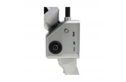
| Camera Parameter |
| Resolution | 2*20 MP |
| FOV | Horizontal 270° |
| Shooting Mode | Isochronous |
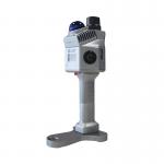
Application of SLAM LiDAR Scanning System GS-100G
Package SLAM LiDAR Scanning System GS-100G
SLAM LiDAR Scanning System GS-100G is packed by suit case with
EVA material liner inside, then covered by hard carton box. It is
suitable for air shipment and sea shipment.