
GGPoS Software-High Accuracy GNSS Positioning And Velocity Determination System
|
|
GGPoS – Precision GNSS Data Processing for Positioning & Velocity
GGPoS is a high-performance GNSS post-processing software developed by Geosun Navigation, capable of handling single- and dual-frequency data from GPS, GLONASS, BeiDou, and Galileo systems. It accurately computes centimeter-level positions and millimeter-per-second velocity, leveraging carrier phase measurements for reliable output. The system integrates an industry-leading single-epoch ambiguity resolution algorithm, enabling rapid solution convergence without the need for traditional initialization procedures. This ensures robust, consistent performance in both stable and dynamic operational environments. Highlights
Typical Use Cases GGPoS is widely deployed across multiple professional domains, including but not limited to:
Thanks to its modular system design, GGPoS allows for flexible feature extension and customization, offering tailored solutions to fit the needs of diverse applications and user requirements.
Free Software for Testing-Document Overview:Trial Software Information Click here to watch the video:Positioning Altitude Aerial Photogrammetry Trajectory Process Software
PPK Process
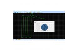
Select the Satellites and GNSS Date Decode (the .kqs file to .20o file)
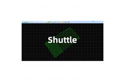
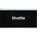
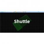
The GNSS results from Shuttle (kinematic Differencial GNSS)
GNSS Result |
| Product Tags: Positioning And Velocity Determination System GNSS Velocity Determination System velocity determination system gnss |
|
Shuttle Software –Positioning Altitude Aerial Photogrammetry Trajectory Process Software |
|
Shuttle Software – High-Precision GNSS/INS Post-Processing System |
|
GGPoS Software – High-Precision GNSS Positioning and Velocity Solution |
|
GGPoS Software-High Accuracy GNSS Positioning And Velocity Determination System |