
31 - 40 of 78
road mapping lidar 3d scanner
Selling leads
|
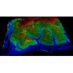
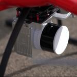
...LiDAR Scanning System HESAI XTM2X Sensor High Accuracy Terrain Mapping UAV Surveying Geosun gAirHawk Series GS-260X LiDAR Scanning System gAirHawk ...
2025-07-31 00:16:27
|
|
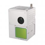
...100C+ LIDAR SCANNING SYSTEM Drone LiDAR Scanning System Mounted on DJI M600 Pro Application for Mapping and Survey gAirHawk GS-100C+ is a kind of ...
2025-07-31 00:16:27
|
|
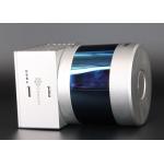
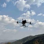
... UAV LIDAR SCANNING SYSTEM Drone LiDAR Scanning System mounted on DJI M300 Application for Topographic Mapping gAirHawk GS-260S is a kind of Mid...
2025-07-31 00:16:27
|
|
... Drone LiDAR Geosun GS-260X Aerial Mapping Solution Geosun gAirHawk Series GS-260X Drone LiDAR Scanning System gAirHawk GS-260X is a kind of middle...
2025-07-31 00:16:27
|

|
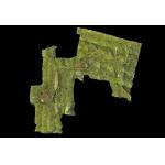
...Mapping Drone LiDAR GS-260X Colored Point Cloud High Accuracy Affordable Cost Geosun gAirHawk GS-260X UAV LiDAR Scanning System gAirHawk GS-260X is ...
2025-07-31 00:16:27
|
|
...Mapping Drone Payload UAV LiDAR Surveying Geosun Partner In Indian Multi-Rotor Support High Precision Geosun gAirHawk Series GS-260X uav LiDAR ...
2025-07-31 00:16:27
|
|
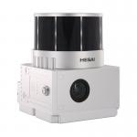
...Mapping Height Difference 400m High Accuracy Geosun GS-260X UAV LiDAR Scanning System HESAI Sensor Geosun gAirHawk Series GS-260X uav LiDAR ...
2025-07-31 00:16:27
|
|
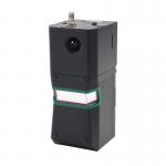
... Series GS-100G SLAM LiDAR Scanning System HESAI XT16 Slam Algorithms Under Ground Mapping 3D Data Collection Geosun gFireEye Series GS-100G SLAM ...
2025-07-31 00:16:27
|
|
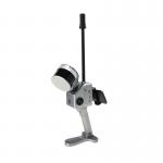
... Mapping Mobile LiDAR Solution Geosun gAirHawk Series GS-100V Geosun gAirHawk Series GS-100V Mobile LiDAR Scanning System gAirHawk GS-100V is a ...
2025-07-25 11:53:29
|
|
...acquisition system, integrated Riegl laser scanner, GNSS and IMU positioning and attitude determination system, and storage control unit, is able ...
2025-07-25 11:53:41
|