
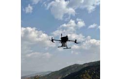
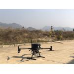
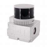
Terrain Mapping GS-260X UAV LiDAR Scanning System HESAI Sensor
|
|
Terrain Mapping Height Difference 400m High Accuracy Geosun GS-260X UAV LiDAR Scanning System HESAI Sensor
Geosun gAirHawk Series GS-260X uav LiDAR Scanning System For more specification please check here: GS-260X LiDAR Scanning System.pdf
Applications of uav LiDAR Scanning System GS-260X Terrain height difference: 400m Terrain follow flight height: 120m Flight speed: 8m/s Root mean square: 2.5cm Compared with the traditional operation mode, the operation
efficiency is greatly improved, based on the ground point to
generate contours (in line with 1:500 topographic map), restore the
real landform. Free trial software of uav LiDAR Scanning System GS-260X Free trial test, achieve high precision The Guideline of LiDAR Usage and Reference.pdf Point Cloud Pre-Processing Software Integrated With Trajectory
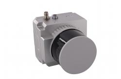
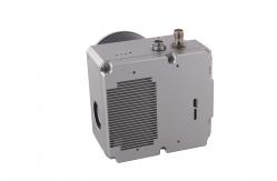
Processing----Geosun Self-developed gAirHawk 5.0 Specification of uav LiDAR Scanning System GS-260X
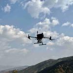
UAV LiDAR Scanning System GS-260X is packed by suit case with EVA material liner inside, then covered by hard carton box. It is suitable for air shipment and sea shipment.
|
|||||||||||||||||||||||||||||||||||||||||||||||||||||||||||||||
| Product Tags: HESAI Sensor UAV LiDAR System GS-260X UAV LiDAR System Terrain Mapping UAV LiDAR | |||||||||||||||||||||||||||||||||||||||||||||||||||||||||||||||

|
Terrain Mapping Aerial Surveying Geosun UAV LiDAR System GS-130X High Precision |

|
GS-100V UAV LiDAR System 360 Degree Fov Laser Sensor Colored Point Cloud Free Software |
|
AirPort Construction UAV LiDAR GS-260X High End Pos Built In RGB Camera |

|
GAirHawk Series GS-2000N LiDAR Scanning System Long Detection Airborne Mapping |
|
Geosun GAirHawk Series GS-260X UAV LiDAR Scanning System HESAI XTM2X Sensor |
|
Terrain Mapping GS-260X UAV LiDAR Scanning System HESAI Sensor |