
1 - 10 of 32
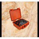
3d subsurface mapping unit
Selling leads

|
Global food security in an era of water scarcity demands a revolution in agricultural water management. The traditional approach of irrigating uniform ...
2026-05-23 00:35:23
|

|
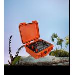
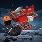
...3D Subsurface Resistivity Scanner WDJD-4A: Uncompromised Geophysical Performance in the Planet's Most Hostile Operating Conditions From the frozen ...
2026-06-19 00:09:46
|
|
"When Mountains Crumble & Deserts Burn: The Unbreakable Tool Saving Geoteams" Imagine dangling from a glacier crevasse while underground ...
2025-06-23 12:15:53
|

|
... increasingly face regulatory and public expectations to avoid, minimize, or mitigate impacts on sensitive environments and cultural heritage. The ...
2026-06-05 07:30:19
|
|
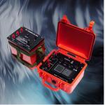
WDDS-3C: Ensuring Water Access Through Advanced Technology Addressing global water challenges requires innovative solutions, and the WDDS-3C stands at ...
2025-08-28 13:58:28
|

|
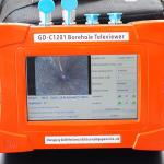
Precision Underground Exploration – Master Your Subsurface Environment Take complete control of your underground investigations with the GD-C1201 ...
2026-06-19 00:09:46
|
|
3D Cave Scanner and Detection System is a comprehensive solution designed to accurately map and analyze underground cave formations. The system ...
2024-12-10 00:42:28
|
|
3D Downhole Optical Imaging Camera Mapping For Deep Borehole Formation Logging The borehole imaging camera, also known as the borehole TV imager, is ...
2024-12-09 22:21:14
|
|
"Carbon-Negative Exploration: How Our Tool Heals Earth While Mapping It" Traditional gear guzzles diesel. The WDA-1A runs on sunlight and genius. Its ...
2025-06-25 00:09:25
|
|
Zero-Footprint Discovery: Ecology-First Mineral Mapping The Sustainability Mandate Modern exploration must balance profit and planet. Our EcoScan IP ...
2025-08-21 00:14:21
|