
21 - 30 of 32
3d subsurface mapping unit
Selling leads
|
...-centric automation. Its dual-mode operation (time-domain and frequency-domain) supports diverse workflows, from quick regional scans to detailed ...
2025-05-29 16:32:25
|
|
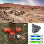
... (EPS) Seismic equipment is used to study the earth's subsurface by generating and recording signals that travel through the earth. These signals ...
2026-06-19 00:09:46
|
|
WGMD-4 – Your Subsurface Lightsaber for Galactic-Scale Discovery! Beam Down to Planet Earth with Future-Tech Imagine wielding a device that turns ...
2025-06-23 12:15:58
|

|
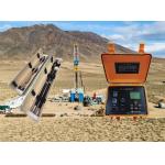
... technologies that fundamentally change how subsurface data is collected, processed, and applied to drilling operations. The GDP-3D platform serves ...
2026-06-19 00:09:46
|
|
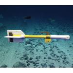
... ensures decade-long reliability EMI Immunity: 99.9% noise rejection from ship electronics Real-Time 3D Mapping: Dual-unit gradiometry visualizes ...
2025-07-24 10:59:00
|
|
...3D Wireless Inclinometer: Precision That Sings, Durability That Roars Forget "tools"—this is your subsurface Stradivarius. Every survey is a ...
2026-06-19 00:09:46
|
|
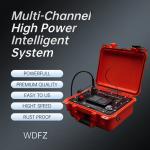
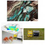
..., making subsurface exploration a breeze! Whether you're diving into Centralized 2D Multi-electrode Resistivity Surveys with the WDZJ-4/WDZJ-120 ...
2026-06-19 00:09:46
|
|
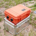
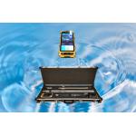
...: The Imaging Resistivity Meter is a state-of-the-art geophysical instrument designed for high-accuracy groundwater detection and subsurface ...
2026-06-19 00:09:46
|

|
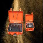
... designed for comprehensive subsurface exploration. It integrates advanced resistivity and IP imaging technologies, making it indispensable for a ...
2026-06-19 00:09:46
|
|
...-2D: Your Unified Hub for Subsurface Intelligence Stop juggling incompatible tools. Our system seamlessly connects with your existing GIS, CAD, and ...
2026-06-19 00:09:46
|