
91 - 100 of 103
lidar mapping 3d scanning
Selling leads

|
gAirHawk GS-2000R Airborn LIDAR SCANNING SYSTEM Airborn LiDAR Scanning System with Long Range Riegl Sensor gAirHawk GS-2000R is a kind of long range, ...
2025-07-25 11:53:29
|
|
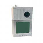
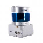
gAirHawk GS-300T Mobile LIDAR SCANNING SYSTEM Mobile LiDAR Scanning System with Livox Tele-15 Laser Sensor gAirHawk GS-300T is a kind of Mid-range, ...
2025-07-28 00:13:17
|
|
gAirHawk GS-260F Mobile LIDAR SCANNING SYSTEM Mobile LiDAR Scanning System Application for City Construction gAirHawk GS-260F is a kind of Mid-range, ...
2025-07-25 11:53:30
|
|
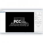
... software independently developed by Geosun Navigation. It is designed to support the full workflow of LiDAR scanning, from field data collection ...
2025-07-25 11:56:10
|
|
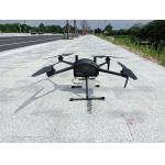
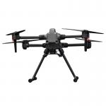
...LiDAR Drone Safety Aircraft Aerial Survey Operation Support GS-800 multi-rotor UAV aerial photographing and mapping system is made of high-strength ...
2025-07-25 11:55:21
|
|
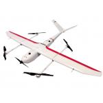
...Mapping & Survey GS-S300 is a pure electric VTOL fixed wing drone, with a simple and smooth appearance design, which enables the drone to cruise at ...
2025-07-25 11:54:13
|
|
Multi-Rotor Drone Application for Mapping & Survey The GS-L400 is designed specifically for inspection, surveying, security, and wilderness rescue ...
2025-07-25 11:54:47
|
|
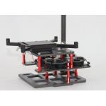
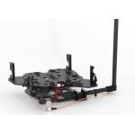
Mounting Kits for DJI M210, M350/300, M600 Pro and other brands. DJI drones are good application for survey & mapping, especially for DJI M210, M300 ...
2025-07-25 11:53:58
|
|
Mounting Kits for DJI M210, M300, M600 Pro and other brands. DJI drones are good application for survey & mapping, especially for DJI M210, M300 and ...
2025-07-25 11:53:59
|
|
PointCloudCreater 2.0 Software Introduction Integrated LiDAR Data Pre-Processing Software with Built-in Trajectory and Point Cloud Calculation ...
2025-07-25 11:56:05
|