
Multi Rotor LiDAR Drone Safety Aircraft Aerial Survey Operation Support
|
Detailed Product Description
|
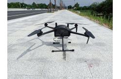
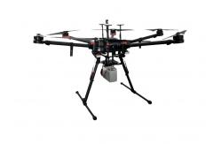
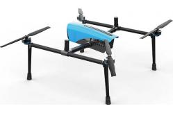
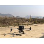
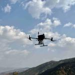
Multi Rotor LiDAR Drone Safety Aircraft Aerial Survey Operation Support GS-800 multi-rotor UAV aerial photographing and mapping system is
made of high-strength carbon fiber, with novel and lightweight fuselage design, smart, stable, flexible, and
low noise. It supports simulated flight, long flight time, suitable for operation in cities, towns and
mountainous areas. GS-800 multi-rotor UAV aerial photographing and mapping system,
simple to operate and convenient to transport, can carry out simple and stable flight without too much
technical training. It is widely used in geological
exploration, remote sensing mapping, environmental protection,
meteorological exploration, disaster monitoring, aerial
survey, line and pipeline inspection, urban patrol and so on.
Small and medium-sized mapping, aerial mapping, aerial monitoring,
power planning and design, land survey, forestry application, earthquake relief and other industries. High Efficiency Endurance without payload ≤ 85mins
Endurance with GS-100M+ ≤
65mins Endurance with GS-00C+≤ 50mins
Endurance with GS-30X/GS-260X≤
40mins Easy Operation Support simulated flight and adapt to mountain operation Support to import KML and accurately plan the survey area Automatic figure 8 flight, coordinated turn Aircraft self inspection protection and pre flight inspection
protection to avoid misoperation Automatic return with low power, automatic return with broken chain
and no fly zone are set to reduce potential safety hazards Magnetic compass abnormal protection, attitude protection and
broken propeller protection provide escort for safe operation
Technical Parameter
Application for Mapping & Survey
Package Information
|
||||||||||||||||||||||||||||
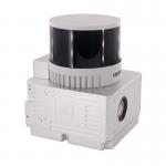
| Product Tags: Multi Rotor LiDAR Drone Aerial Survey Operation LiDAR Drone |
Related Products

|
Terrain Mapping Aerial Surveying Geosun UAV LiDAR System GS-130X High Precision |

|
GS-100V UAV LiDAR System 360 Degree Fov Laser Sensor Colored Point Cloud Free Software |
|
AirPort Construction UAV LiDAR GS-260X High End Pos Built In RGB Camera |

|
GAirHawk Series GS-2000N LiDAR Scanning System Long Detection Airborne Mapping |
|
Geosun GAirHawk Series GS-260X UAV LiDAR Scanning System HESAI XTM2X Sensor |
|
Terrain Mapping GS-260X UAV LiDAR Scanning System HESAI Sensor |
Email to this supplier