
71 - 80 of 87
geosun drone mounted lidar
Selling leads
|
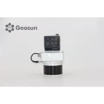
...960 is a cutting-edge high-precision UAV LiDAR scanning system developed by Geosun Navigation. Its integrated design combines surveying-grade LiDAR...
2025-07-25 11:55:03
|
|
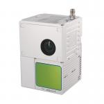
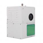
gAirHawk GS-100C+ LIDAR SCANNING SYSTEM Drone LiDAR Scanning System Mounted on DJI M600 Pro Application for Mapping and Survey gAirHawk GS-100C+ is a ...
2025-07-29 00:11:05
|
|
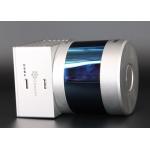
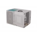
gAirHawk GS-260S UAV LIDAR SCANNING SYSTEM Drone LiDAR Scanning System mounted on DJI M300 Application for Topographic Mapping gAirHawk GS-260S is a ...
2025-07-29 00:11:05
|
|
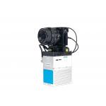
gAirHawk GS-100M+ LIDAR SCANNING SYSTEM Drone LiDAR Scanning System Mounted on DJI M600 Pro Application for Mapping and Survey gAirHawk GS-100M+ is a ...
2025-07-25 11:54:03
|
|
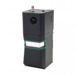
... LiDAR point cloud data acquisition system, integrated HESAI XT laser scanner, GNSS and IMU positioning and attitude determination system, and ...
2025-07-25 11:54:18
|
|
...LiDAR Scanning System GS-100C+ Livox Avia Multiple Platform built-in 26MP RGB Camera Topography Free Software Drone LiDAR Scanning System Mounted ...
2025-07-29 00:11:05
|
|
... gAirHawk GS-100C+ is a kind of light compact LiDAR point cloud data acquisition system, integrated Livox new generation laser scanner, GNSS and ...
2025-07-29 00:11:05
|
|
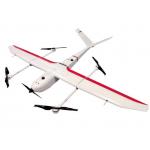
...Drone Application for Mapping & Survey GS-S300 is a pure electric VTOL fixed wing drone, with a simple and smooth appearance design, which enables ...
2025-07-25 11:54:13
|
|
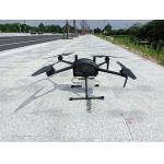
Multi Rotor LiDAR Drone Safety Aircraft Aerial Survey Operation Support GS-800 multi-rotor UAV aerial photographing and mapping system is made of high...
2025-07-25 11:55:21
|
|
Long Range Laser Scanning VTOL UAV Vehicle Supported Five Echo Colored Point Cloud Free Trajectory Processing gAirHawk GS-1350W is a kind of long ...
2025-07-29 00:11:05
|