
41 - 50 of 89
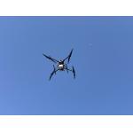
airborne mapping lidar scanning system
Selling leads
|
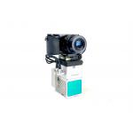
gAirHawk GS-260F UAV LIDAR SCANNING SYSTEM Drone LiDAR Scanning System Application for Mapping and Survey GS 260F Mobile LiDAR System - YouTube ...
2025-07-30 00:11:24
|
|
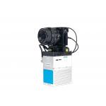
...Mapping HESAI XT32 Senor UAV LiDAR GS-260X Colored Point Cloud Free Pre-Processing software High Accuracy UAV LiDAR Scanning System GS-260X ...
2025-07-30 00:11:24
|
|
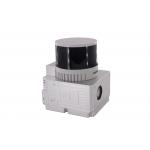
gAirHawk GS-100C+ LIDAR SCANNING SYSTEM Drone LiDAR Scanning System Mounted on DJI M600 Pro Application for Mapping and Survey gAirHawk GS-100C+ is a ...
2025-07-30 00:11:24
|
|
gAirHawk GS-260S UAV LIDAR SCANNING SYSTEM Drone LiDAR Scanning System mounted on DJI M300 Application for Topographic Mapping gAirHawk GS-260S is a ...
2025-07-30 00:11:24
|
|
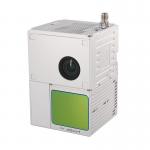
gAirHawk GS-100M+ LIDAR SCANNING SYSTEM Drone LiDAR Scanning System Mounted on DJI M600 Pro Application for Mapping and Survey gAirHawk GS-100M+ is a ...
2025-07-25 11:54:03
|
|
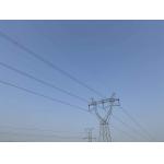
Power Line Inspection Aerial Mapping UAV LiDAR Drone Mapping Colored Point Cloud High Accuracy Geosun gAirHawk Series GS-260X UAV LiDAR Scanning ...
2025-07-30 00:11:24
|
|
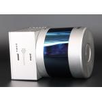
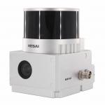
gAirHawk GS-260P LIDAR SCANNING SYSTEM Mobile LiDAR Scanning System with DJI L1 Laser Sensor gAirHawk GS-260P is a kind of light compact LiDAR point ...
2025-07-30 00:11:24
|

|
Aerial Mapping GS-100V UAV LiDAR Scanning System 360 Degree Fov Laser Sensor Colored Point Cloud Free Software Geosun gAirHawk LiDAR Scanning System ...
2025-07-30 00:11:24
|
|
Drone Lidar Scanner Geosun GS-130X 3D Scanning Built-In RGB Camera Total Aerial Solution DJI M300 Cost Effective Application of UAV LiDAR Scanning ...
2025-07-30 00:11:24
|
|
Forestry Surveying Drone LiDAR Geosun GS-260X Aerial Mapping Solution Geosun gAirHawk Series GS-260X Drone LiDAR Scanning System gAirHawk GS-260X is a ...
2025-07-30 00:11:24
|