
1 - 10 of 27
aerial surveying uav lidar system
Selling leads
|
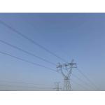
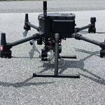
Power Line Inspection Aerial Mapping UAV LiDAR Drone Mapping Colored Point Cloud High Accuracy Geosun gAirHawk Series GS-260X UAV LiDAR Scanning ...
2025-07-28 00:13:17
|

|
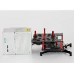
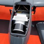
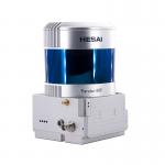
...tem GS-130X integrates Hesai XT32 laser sensor and all built-in units to create a futuristic look for your diversified LiDAR solution services...
2025-07-28 00:13:17
|
|
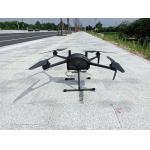
...LiDAR Drone Safety Aircraft Aerial Survey Operation Support GS-800 multi-rotor UAV aerial photographing and mapping system is made of high-strength ...
2025-07-25 11:55:21
|
|
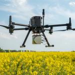
Uav Lidar Mapping Built-In 26MP RGB Camera Strong Penetration Power Line Forestry Surveying Geosun gAirHawk Sesries GS-130X LiDAR uav Scanning System ...
2025-07-28 00:13:17
|
|
...20W 1.92km2 Triple Echo Livox Avia Laser Sensor UAV LiDAR System Land Surveying UAV LiDAR Scanning System with Triple Echo Livox Avia Laser Sensor ...
2025-07-28 00:13:17
|
|
Smart City Application UAV LiDAR System Geosun GS-130X 3D Surveying And Mapping Hesai XT32 Sensor Applications Of uav LiDAR Scanning System Specificat...
2025-07-28 00:13:17
|
|
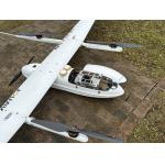
Fixed Wing Drone UAV LiDAR GS-130X HESAI XT32 3D Mapping Strong Penetration Geosun gAirHawk Sesries GS-130X uav LiDAR Scanning System LiDAR Scanning ...
2025-07-28 00:13:17
|
|
Land Surveying Vtol LiDAR Long Detection Geosun gAirHawk GS-2000N Geosun gAirHawk Series uav LiDAR Scanning System GS-2000N UAV LiDAR Scanning System ...
2025-07-28 00:13:17
|
|
gAirHawk GS-260F UAV LIDAR SCANNING SYSTEM Drone LiDAR Scanning System Application for Mapping and Survey with DJI Drone gAirHawk GS-260F is a kind of ...
2025-07-28 00:13:17
|
|
Forestry Surveying Drone LiDAR Geosun GS-260X Aerial Mapping Solution Geosun gAirHawk Series GS-260X Drone LiDAR Scanning System gAirHawk GS-260X is a ...
2025-07-28 00:13:17
|