
1 - 10 of 79
high precision lidar scanning system
Selling leads
|
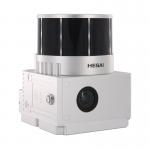
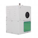
... LiDAR point cloud data acquisition system, integrated HESAI XT16 laser scanner, GNSS and IMU positioning and attitude determination system, and ...
2025-07-28 00:13:17
|
|
...Scanning System Supported Seven Echo Colored Point Cloud Free Trajectory Processing The GS-960 is a cutting-edge high-precision UAV LiDAR scanning ...
2025-07-25 11:55:03
|
|
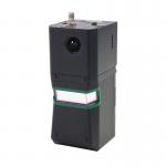
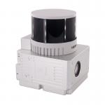
...LiDAR Scanning System HESAI Pandar 40P Versatile Application RTK Model Power Line Geosun gAirHawk Series GS-260F LiDAR Scanning System GS-260F ...
2025-07-25 11:53:47
|

|
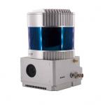
...LiDAR Scanning System 7 Echos Long Detection Aerial VTOL Mapping High Accuracy Geosun gAirHawk Series GS-2000N LiDAR Scanning System gAirHawk GS...
2025-07-28 00:13:17
|

|
... scanner, GNSS and IMU positioning and attitude determination system, and storage control unit, is able to real-time, dynamically, massively ...
2025-07-25 11:53:41
|
|
...LiDAR Scanning System Entry-Level 3D Data Collection Livox Avia Sensor Geosun gAirHawk Sesries GS-100C+ LiDAR Scanning System gAirHawk GS-100C+ is ...
2025-07-28 00:13:17
|
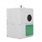
Geosun gAirHawk GS-100C LiDAR Scanning System Skyport DJI M300 Livox Avia Sensor Colored Point Cloud
|
...LiDAR Scanning System Skyport DJI M300 Livox Avia Sensor Colored Point Cloud Geosun gAirHawk GS-100C LiDAR Scanning System gAirHawk GS-100C is a ...
2025-07-28 00:13:17
|
|
...LiDAR Geosun GS-260X Geosun gAirHawk Sesries GS-260X LiDAR Scanning System gAirHawk GS-260X is a kind of Mid-range, compact LiDAR point cloud data ...
2025-07-28 00:13:17
|

|
... scanner, GNSS and IMU positioning and attitude determination system, and storage control unit, is able to real-time, dynamically, massively ...
2025-07-25 11:53:25
|

|
...LiDAR Aerial Mapping Drone Surveying City Construction 3D Modeling Geosun gAirHawk LiDAR Scanning System GS-260H gAirHawk GS-260X is a kind of ...
2025-07-28 00:13:17
|