
81 - 88 of 88
high precision lidar scanning drone
Selling leads
|
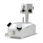
...LiDAR Scanning System The gCollector-M302 Road Information Collection system is a mobile real scense collection system that integrates LiDAR, ...
2025-07-30 00:11:24
|
|
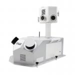
...LiDAR Scanning System The gCollector-M502 Road Information Collection system is a mobile real scense collection system that integrates LiDAR, ...
2025-07-30 00:11:24
|
|
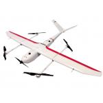
...Drone Application for Mapping & Survey GS-S300 is a pure electric VTOL fixed wing drone, with a simple and smooth appearance design, which enables ...
2025-07-25 11:54:13
|
|
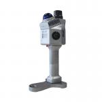
...LiDAR System Land Surveying UAV LiDAR Scanning System with Triple Echo Livox Avia Laser Sensor gAirHawk GS-100M+ is a kind of light compact LiDAR ...
2025-07-30 00:11:24
|
|
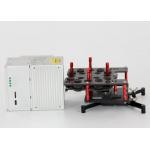
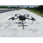
Multi Rotor LiDAR Drone Safety Aircraft Aerial Survey Operation Support GS-800 multi-rotor UAV aerial photographing and mapping system is made of high...
2025-07-25 11:55:21
|
|
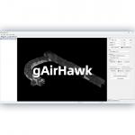
... gAirHawk 5.0 is a powerful LiDAR data acquisition and pre-processing software independently developed by Geosun Navigation. Designed for use with ...
2025-07-25 11:56:11
|
|
..., it captures precise 3D point clouds in GNSS or GNSS-denied environments. Its compact design ensures easy mobility for indoor and outdoor mapping, ...
2025-07-25 11:56:20
|
|
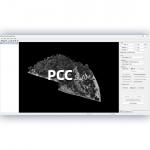
...LiDAR Data Pre-Processing Software with Built-in Trajectory and Point Cloud Calculation PointCloudCreater 2.0 is an advanced LiDAR data pre...
2025-07-25 11:56:05
|