
71 - 80 of 80
high precision lidar 3d scanner
Selling leads
|
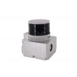
...3D Mapping HESAI XT32 Senor UAV LiDAR GS-260X Colored Point Cloud Free Pre-Processing software High Accuracy UAV LiDAR Scanning System GS-260X ...
2025-07-28 00:13:17
|
|
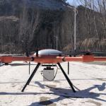
...LiDAR Scanning Support VTOL Airborne High Accuracy DEM Geosun gAirHawk Series GS-2000N UAV LiDAR Scanning System UAV LiDAR Scanning System gAirHawk ...
2025-07-28 00:13:17
|

|
... System gAirHawk GS-2000N is a kind of long range, compact LiDAR point cloud data acquisition system, integrated FT-1500H long range laser scanner, ...
2025-07-28 00:13:17
|
|
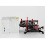
...LiDAR System Land Surveying UAV LiDAR Scanning System with Triple Echo Livox Avia Laser Sensor gAirHawk GS-100M+ is a kind of light compact LiDAR ...
2025-07-28 00:13:17
|
|
... sensor, GNSS and IMU positioning and attitude determination system, and storage control unit, is able to real-time, dynamically, massively collect ...
2025-07-28 00:13:17
|
|
..., it captures precise 3D point clouds in GNSS or GNSS-denied environments. Its compact design ensures easy mobility for indoor and outdoor mapping, ...
2025-07-25 11:56:20
|
|
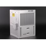
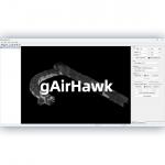
... gAirHawk 5.0 is a powerful LiDAR data acquisition and pre-processing software independently developed by Geosun Navigation. Designed for use with ...
2025-07-25 11:56:11
|
|
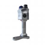
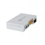
High-Performance Survey GNSS Receiver, CORS Reference Station, Deformation Monitoring System Geosun gMOS is a GNSS real-time high-precise deformation ...
2025-07-25 11:53:49
|
|
... AGS 302 (301/303) adds a high-precision inertial navigation (IMU) module, no matter how the fuselage tilts during the aviation flight, it can ...
2025-07-25 11:53:50
|
|
...AGS 300 GNSS INS System adds a high-precision inertial navigation (IMU) module, no matter how the fuselage tilts during the aviation flight, it can ...
2025-07-25 11:53:51
|