
81 - 90 of 95
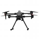
750g 3d mapping lidar
Selling leads
|
EU Airborne UAV LiDAR Scanning GS-130X Hesai XT32 Laser Senor High Accuracy Pos Colored Point Cloud Geosun gAirHawk uav LiDAR Scanning System GS-130X ...
2025-07-28 00:13:17
|
|
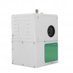
UAV LiDAR Scanning System GS-100C+ Livox Avia Multiple Platform built-in 26MP RGB Camera Topography Free Software Drone LiDAR Scanning System Mounted ...
2025-07-28 00:13:17
|
|
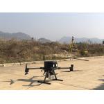
GS-260F RTK Model Drone LiDAR Scanner HESAI Pandar40P Multi Platform Free Trajectory Processing Geosun gAirHawk Series Drone LiDAR Scanning System GS...
2025-07-25 11:55:45
|
|
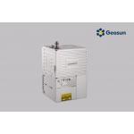
Geosun GAirHawk Series GS-260X UAV LiDAR Scanning System HESAI XTM2X Sensor High Acuraccy Geosun gAirHawk Series GS-260X UAV LiDAR Scanning System ...
2025-07-28 00:13:17
|
|
AirPort Construction UAV LiDAR GS-260X High-End Pos Built-In RGB Camera Colored Point Cloud One Key Processing Geosun gAirHawk GS-260X UAV LiDAR ...
2025-07-28 00:13:17
|
|
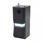
GS-100C+ LiDAR Scanning System Entry-Level 3D Data Collection Livox Avia Sensor Geosun gAirHawk Sesries GS-100C+ LiDAR Scanning System gAirHawk GS...
2025-07-28 00:13:17
|
|
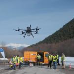
Long Range Laser Scanning VTOL UAV Vehicle Supported Five Echo Colored Point Cloud Free Trajectory Processing gAirHawk GS-1350W is a kind of long ...
2025-07-28 00:13:17
|
|
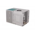
Long Range Laser Scanning System Supported Seven Echo Colored Point Cloud Free Trajectory Processing The GS-960 is a cutting-edge high-precision UAV ...
2025-07-25 11:55:03
|
|
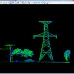
Multi-Rotor Drone Application for Mapping & Survey The GS-L400 is designed specifically for inspection, surveying, security, and wilderness rescue ...
2025-07-25 11:54:47
|
|
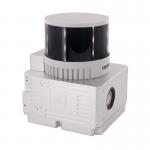
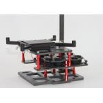
Mounting Kits for DJI M210, M350/300, M600 Pro and other brands. DJI drones are good application for survey & mapping, especially for DJI M210, M300 ...
2025-07-25 11:53:58
|