
31 - 36 of 36
450m lidar terrain surveying lidar
Selling leads
|
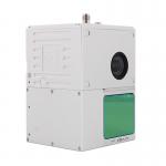
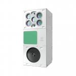
... gAirHawk GS-100C+ is a kind of light compact LiDAR point cloud data acquisition system, integrated Livox new generation laser scanner, GNSS and ...
2025-07-29 00:11:05
|
|
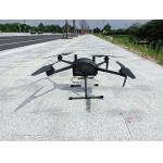
Multi Rotor LiDAR Drone Safety Aircraft Aerial Survey Operation Support GS-800 multi-rotor UAV aerial photographing and mapping system is made of high...
2025-07-25 11:55:21
|
|
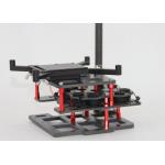
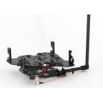
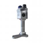
Mounting Kits for DJI M210, M350/300, M600 Pro and other brands. DJI drones are good application for survey & mapping, especially for DJI M210, M300 ...
2025-07-25 11:53:58
|
|
Mounting Kits for DJI M210, M300, M600 Pro and other brands. DJI drones are good application for survey & mapping, especially for DJI M210, M300 and ...
2025-07-25 11:53:59
|
|
UAV LiDAR Scanning System with Integrated Multispectral Camera Geosun GS-100E LiDAR Scanning System Application for 3D Surveying and Mapping GS-100E ...
2025-07-25 11:54:19
|
|
... clouds in GNSS or GNSS-denied environments. Its compact design ensures easy mobility for indoor and outdoor mapping, including urban surveys, ...
2025-07-25 11:56:20
|