
21 - 30 of 36
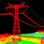
450m lidar terrain surveying lidar
Selling leads
|
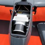
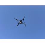
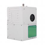
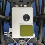
Fixed Wing Drone UAV LiDAR GS-130X HESAI XT32 3D Mapping Strong Penetration Geosun gAirHawk Sesries GS-130X uav LiDAR Scanning System LiDAR Scanning ...
2025-07-29 00:11:05
|
|
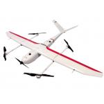
VTOL Fixed Wing Drone Application for Mapping & Survey GS-S300 is a pure electric VTOL fixed wing drone, with a simple and smooth appearance design, ...
2025-07-25 11:54:13
|
|
gCollector-M302 Road Information Collection LiDAR Scanning System The gCollector-M302 Road Information Collection system is a mobile real scense ...
2025-07-29 00:11:05
|
|
gCollector-M502 Road Information Collection LiDAR Scanning System The gCollector-M502 Road Information Collection system is a mobile real scense ...
2025-07-29 00:11:05
|
|
gAirHawk GS-260F UAV LIDAR SCANNING SYSTEM Drone LiDAR Scanning System Application for Mapping and Survey GS 260F Mobile LiDAR System - YouTube ...
2025-07-29 00:11:05
|
|
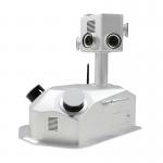
...LiDAR System Geosun GS-100C+ Aerial Mapping Survey High Precision IMU Coloured Point Cloud Geosun Thailand partner have a on-site trainning at ...
2025-07-29 00:11:05
|
|
...LiDAR Scanning System Geosun GS-260X PPK RTK Processing Geosun gAirHawk Series GS-260X Drone LiDAR Scanning System Drone LiDAR Scanning System GS...
2025-07-29 00:11:05
|
|
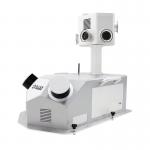
...LiDAR GS-100C+ Support DJI Matrice 300 Yuneec H850 Aerial Mapping Geosun gAirHawk Series GS-100C+ Drone LiDAR Drone LiDAR scanning system GS-100C+ ...
2025-07-29 00:11:05
|
|
...LiDAR Scanning System High Accuracy Colored Point Cloud Long Detection Airborne Mapping Geosun gAirHawk Series GS-2000R LiDAR Scanning System The ...
2025-07-25 11:55:05
|
|
gAirHawk GS-100M+ LIDAR SCANNING SYSTEM Drone LiDAR Scanning System Mounted on DJI M600 Pro Application for Mapping and Survey gAirHawk GS-100M+ is a ...
2025-07-25 11:54:03
|