
61 - 70 of 139
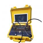
subsurface imaging geophysical sensor
Selling leads
|
...oil and gas exploration to gather data on Earth's subsurface, which can be used to make informed decisions on exploration and drilling projects. ...
2024-12-09 22:21:14
|
|
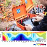
500M Super Electric Multi-electrode Resistivity Survey System Geophysical Exploration Instrument Ground Water Detector Product Introduce The WGMD-9 ...
2026-06-19 00:09:46
|
|
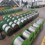
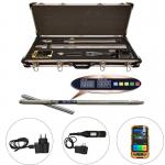
Steel Wire Armored Cable Borehole Logging Cable Borehole logging cables are used to lower logging tools and sensors into boreholes to collect ...
2025-05-29 16:31:28
|
|
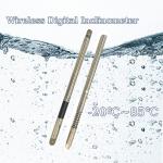
Geophysical Wireless Digital Inclinometer GDP-3D Borehole Deviation Survey Drilling Inclinometer The GDP-3D Drilling Direction Inclinometer, Borehole ...
2026-06-19 00:09:46
|
|
...Geophysical Exploration Fiber Optic Gyroscopes Inclinometer Manufacturer The GDP-3D Drilling Direction Inclinometer is a dependable and precise ...
2026-06-19 00:09:46
|

|
...r geophysical data with comprehensive intelligence integration. Our platform combines multiple data streams into actionable insights through ...
2025-09-18 00:17:18
|
|
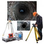
Vertical Hole Imaging Device Full Hole Wall Imaging System Digital Drilling Core System Comprehensive Technical Overview of the Full Hole Wall Imaging ...
2026-06-19 00:09:46
|

|
Knowledge Transfer: Making Experts Out of Beginners Demystifying Geophysical Expertise Complex exploration technology becomes intuitively accessible ...
2025-08-28 13:58:28
|
|
"When Mountains Crumble & Deserts Burn: The Unbreakable Tool Saving Geoteams" Imagine dangling from a glacier crevasse while underground ...
2025-06-23 12:15:53
|
|
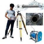
2D/3D Borehole Imaging Camera Geological Survey Optical Televiewer Borehole Digital Scanner for Water Well Detection The GD-C1201 3D Optical ...
2026-06-19 00:09:46
|