
71 - 80 of 99
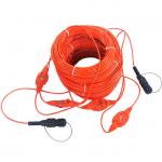
20ms geophysical survey euipment
Selling leads
|
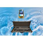
GDP-3D Wireless Inclinometer: Precision That Sings, Durability That Roars Forget "tools"—this is your subsurface Stradivarius. Every survey is a ...
2025-08-05 00:16:06
|
|
Ore Prospector Geophysical Digital Software Proton Magnetometer Measurement range 30,000nT~70,000nT Resolution 0.1nT Precision ±1nT Allowed gradient ...
2024-12-09 22:21:14
|
|
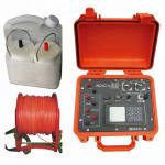
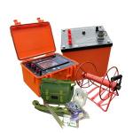
Electrical Resistivity Survey For Groundwater Investigation Induced Polarization Instrument The WDJD-3A multi-function digital dc resistivity & ip ...
2025-08-05 00:16:05
|
|
Products Interview WDDS-2C Digital DC Resistivity Meter The Digital Resistivity Meter can measures the resistivity of fluids, slurries, and semisolids ...
2024-12-09 23:14:37
|
|
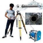
2D/3D Borehole Imaging Camera Geological Survey Optical Televiewer Borehole Digital Scanner for Water Well Detection The GD-C1201 3D Optical ...
2025-08-05 00:16:06
|
|
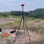
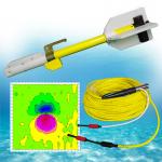
GD-02 Marine Magnetics magnetometer High Resolution Cesium optical pump magnetometer Marine Gradiometers for Marine Survey Main Feature Cesium high ...
2024-12-09 23:37:26
|

|
Instant-Action Aeromagnetic Systems for Time-Critical Missions Operational Agility Redefined Chongqing Gold Mechanical&Electrical Equipment Co.,Ltd. ...
2025-07-24 00:19:24
|
|
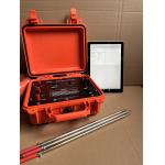
Hydro And Terrestrial Exploration Terrameter Measure Apparent Resistivity And IP Apparent resistivity is a parameter used to reflect changes in the ...
2024-12-09 22:21:14
|
|
24Channel Seismic Refraction Equipment for Geophysical Exploration Seismic refraction equipment is used to measure and map subsurface properties of ...
2024-12-09 22:21:14
|
|
... of the subsurface. The data collected from seismic surveys is used to create images of the subsurface, which can help geologists and engineers ...
2024-12-09 22:21:14
|