
80m-120m Easyscan X10 Versatile 3D Laser Scanner For Volume Measurement
|


|
Easy Scan X10 / X10+ Versatile 3D laser Scanner Handheld SLAM and
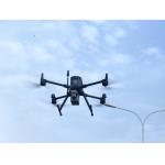
Airborne Drone LiDAR Multiple views from one Products Introduction
*The technical parameters and configuration of our products are subject to change without notice.
Notice: ① Weight includes LiDAR, GNSS,high-precision lMU, and aerial metric camera module②) Perpendicular to the flight direction, with the effective FoV angle of LiDAR③ Weight includes main body,SLAM dock, telescopic rod, and camera4) Tested at 25'c~ 27°C; charging time and power supply time will vary according to different conditions
Feature Ultra-light aerial survey module, image acquisition not limited by LiDAR measurement range, flight height can be appropriately increased to improve the operation efficiency. Accessories Application Case Sample Data Display |
|||||||||||||||||||||||||||||||||||||||||||||||||||||||||||||||||||||||||||||||||||||||||||||||||||||||||||||||
| Product Tags: 120m airborne lidar system 80m airborne lidar system Easyscan X10 3D Laser Scanner | |||||||||||||||||||||||||||||||||||||||||||||||||||||||||||||||||||||||||||||||||||||||||||||||||||||||||||||||

|
80m-120m Easyscan X10 Versatile 3D Laser Scanner For Volume Measurement |

|
Aerial 3D Laser Scanning System For Real 3D And Smart Mining |
|
High Accuracy UAV Aerial LiDAR System EliteScan W50 |

|
EasyScan W30 Airborne LiDAR For Enhanced Aerial Efficiency 905nm Wavelength |

|
Precision Airborne Laser Scanning In Aerial LiDAR Easyscan W30 |

|
W50 LiDAR System Compact Powerful Mapping Tool Compatible To DJI M300 M350 |