
261 - 270 of 281
surveying mapping gps rtk
Selling leads
|
...surveying and mapping software which is developed by the Geoelectron company. Based on years of accumulating market experience, in com- bination ...
2025-05-10 00:12:10
|
|
... Atlas H 10/ H30 /Basic channels 800 Position Rate 5 Hz, optional 20 Hz signal reacquisition
2024-12-09 20:58:36
|
|
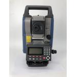
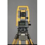
...combines GPS RTK, digital level, and the cheapest Topcon total station technology into a single unit. This total station is designed with a size of ...
2024-12-09 22:48:35
|
|
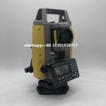
... surveying instrument that uses angle and distance measurement to accurately measure the coordinates of points on the ground. It combines the ...
2024-12-09 22:48:35
|
|
... reflectorless total station is an ideal survey instrument for a wide range of applications. With its advanced GPS RTK technology, it is able to ...
2024-12-09 22:53:18
|
|
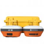
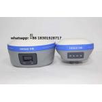
... GNSS receivers The power of IMU-RTK GNSS technology that fits in your hands and a fully integrated GNSS base station add a new scale to GNSS ...
2024-12-09 19:36:27
|
|
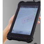
...RTK Android tablet is designed to increase efficiency and productivity of mobile field workforce in any applications requiring centimeter to ...
2024-12-09 22:22:01
|

|
Leica GPS Receiver GeoMato GNSS receiver Trimble RTK R10 MULTI CONSTELLATION Stonex S900A with its 600 channels, provides an excellent on board real ...
2024-12-09 21:14:24
|

|
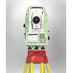
...survey and stakeout tasks easily and efficiently. Building construction, civil engineering, or surveying and mapping professionals benefit from the ...
2025-05-16 07:33:38
|
|
... engineering, or surveying and mapping professionals can benefit from the TS07 in solving their daily professional challenges and tasks: Managing ...
2025-05-16 07:33:38
|