
241 - 250 of 281
surveying mapping gps rtk
Selling leads
|
...surveying, engineering, and mapping applications. It features an image erect and is capable of providing a magnification of 30X with an aperture of ...
2024-12-09 22:53:18
|

|
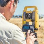
...building construction, civil engineering, surveying, and mapping industries find the TS07 valuable in addressing their daily challenges. Benefits ...
2025-05-16 07:33:38
|

|
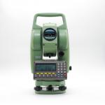
Technical parameter System Configuration Environmental Performance Operating system Linux Operating temperature -30℃ ~ +65℃ Built-in storage 8GB, ...
2024-12-09 21:01:25
|

|
Detail Specification : Perfect Combination Of Garmin Etrex 209X Handheld GPS with Beidou Perfect Combination of eTrex and Beidou Garmin new generation ...
2024-12-09 18:47:22
|

|
Garmin eTrex 309x outdoors handheld high precision GPS Field collection and GIS survey experts beidou binary version Garmin's new generation of GPS+ ...
2024-12-09 19:01:37
|
|
Detail Specification : Handheld GPS area measure land measurement NF198 device surveying Main features 1. Measure area and length of any shape ...
2024-12-09 18:47:22
|
|
|
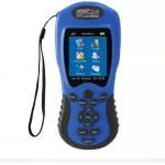
Handheld GPS, 3-axis Compass: Better Resolution and Memory Greater resolution with 240 x 320 display pixels for improved readability Internal memory ...
2024-12-09 20:35:29
|
|
... are the perfect combination that makes Stonex R2 Plus the best friend of every professional surveyor. Cadastral, mapping, staking out, and up to ...
2024-12-09 18:47:22
|
|
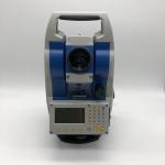
...Electronic Total Station) is a high-tech measuring instrument integrating light, machine and electricity. It is a surveying and mapping instrument ...
2024-12-09 18:47:22
|

|
Products information The S900 GNSS receiver from Stonex features a new, high accuracy multi-constellation antenna, a powerful UHF transmitter and a ...
2024-12-09 18:47:22
|