
1 - 10 of 13
topographic mapping 20 beam uav lidar
Selling leads
|
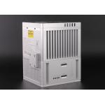
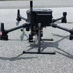
gAirHawk GS-300T LIDAR SCANNING SYSTEM Drone LiDAR Scanning System Mounted on VTOL Fixed wing drone gAirHawk GS-300T is a kind of Mid-range, compact ...
2025-07-28 00:13:17
|
|
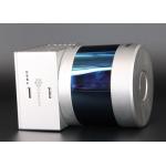
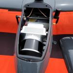
gAirHawk GS-260S UAV LIDAR SCANNING SYSTEM Drone LiDAR Scanning System mounted on DJI M300 Application for Topographic Mapping gAirHawk GS-260S is a ...
2025-07-28 00:13:17
|
|
... gAirHawk GS-100C+ is a kind of light compact LiDAR point cloud data acquisition system, integrated Livox new generation laser scanner, GNSS and ...
2025-07-28 00:13:17
|
|
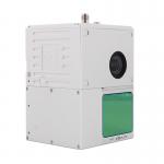
Uav Lidar Mapping Built-In 26MP RGB Camera Strong Penetration Power Line Forestry Surveying Geosun gAirHawk Sesries GS-130X LiDAR uav Scanning System ...
2025-07-28 00:13:17
|
|
... and all built-in units to create a futuristic look for your diversified LiDAR solution services.Stands out with strong penetration and small beam ...
2025-07-28 00:13:17
|
|
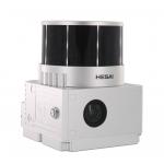
...UAV LiDAR GS-130X HESAI XT32 3D Mapping Strong Penetration Geosun gAirHawk Sesries GS-130X uav LiDAR Scanning System LiDAR Scanning System GS-130X ...
2025-07-28 00:13:17
|

|
...tem GS-130X integrates Hesai XT32 laser sensor and all built-in units to create a futuristic look for your diversified LiDAR solution services...
2025-07-28 00:13:17
|
|
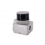
...Mapping HESAI XT32 Senor UAV LiDAR GS-260X Colored Point Cloud Free Pre-Processing software High Accuracy UAV LiDAR Scanning System GS-260X ...
2025-07-28 00:13:17
|
|
...-130X Item Name System Parameters GS-130X Parameters Weight 1.26 kg Measuring accuracy Less than 0.1m @120m Working temperature -20℃~+65℃ Power ...
2025-07-28 00:13:17
|

|
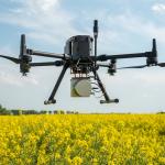
...Mapping for Mine Drone LiDAR Scanning System Geosun GS-130X Colored Point Cloud High Accuracy Geosun gAirHawk Series GS-130X Drone LiDAR Scanning ...
2025-07-28 00:13:17
|