
61 - 67 of 67
geosun lidar
Selling leads

|
Aerial Mapping GS-100V UAV LiDAR Scanning System 360 Degree Fov Laser Sensor Colored Point Cloud Free Software Geosun gAirHawk LiDAR Scanning System ...
2025-07-31 00:16:27
|
|
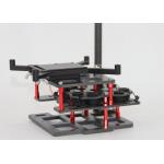
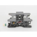
Mounting Kits for DJI M210, M350/300, M600 Pro and other brands. DJI drones are good application for survey & mapping, especially for DJI M210, M300 ...
2025-07-25 11:53:58
|
|
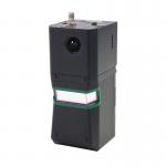
...960 is a cutting-edge high-precision UAV LiDAR scanning system developed by Geosun Navigation. Its integrated design combines surveying-grade LiDAR...
2025-07-25 11:55:03
|
|
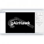
... gAirHawk 5.0 is a powerful LiDAR data acquisition and pre-processing software independently developed by Geosun Navigation. Designed for use with ...
2025-07-25 11:56:11
|
|
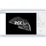
...LiDAR Data Pre-Processing Software with Built-in Trajectory and Point Cloud Calculation PointCloudCreater 2.0 is an advanced LiDAR data pre...
2025-07-25 11:56:05
|
|
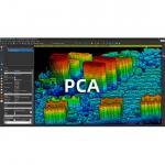
...Application. The PCA is a LiDAR point cloud processing and analyzing soware. The PCA inially designed for Geosun point cloud data, but also is ...
2025-07-25 11:56:03
|
|
Mounting Kits for DJI M210, M300, M600 Pro and other brands. DJI drones are good application for survey & mapping, especially for DJI M210, M300 and ...
2025-07-25 11:53:58
|