
Forestry Surveying Drone LiDAR Geosun GS-260X Aerial Mapping Solution

Products Detailed
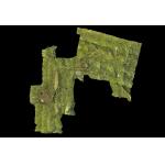
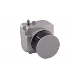
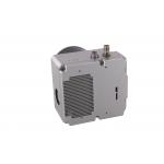
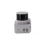
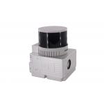
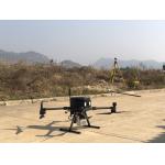
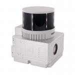
Forestry Surveying Drone LiDAR Geosun GS-260X Aerial Mapping SolutionForestry Surveying Drone LiDAR Geosun GS-260X Aerial Mapping Solution Geosun gAirHawk Series GS-260X Drone LiDAR Scanning System gAirHawk GS-260X is a ... |
| [View Products Detailed] |
| Product Tags: Forestry Surveying Lidar Drone Scanner Lidar Drone Scanner PPK Mode Lidar For 3D Scanning DEM Output |
Related Products

|
Terrain Mapping Aerial Surveying Geosun UAV LiDAR System GS-130X High Precision |

|
GS-100V UAV LiDAR System 360 Degree Fov Laser Sensor Colored Point Cloud Free Software |
|
AirPort Construction UAV LiDAR GS-260X High End Pos Built In RGB Camera |

|
GAirHawk Series GS-2000N LiDAR Scanning System Long Detection Airborne Mapping |
|
Geosun GAirHawk Series GS-260X UAV LiDAR Scanning System HESAI XTM2X Sensor |

|
Terrain Mapping GS-260X UAV LiDAR Scanning System HESAI Sensor |
Email to this supplier