
71 - 80 of 143
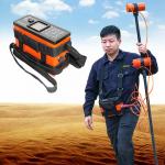
portable magnetic survey instruments
Selling leads
|
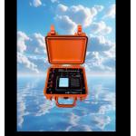
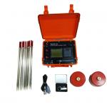
... is a geophysical instrument used for measuring variations in the Earth's magnetic field. It is designed to detect and quantify magnetic anomalies ...
2024-12-09 23:37:26
|
|
... in the fields of petroleum, coal, geological exploration, etc. For the measurement of non-magnetic or weakly magnetic holes, it can effectively ...
2025-07-22 00:28:12
|
|
...Instrument Electrical Resistivity Imaging Meter Introduction 2D Resistivity Imaging uses an array of electrodes (typically 60/ 120) connected by ...
2025-07-22 00:28:12
|
|
...-chip and 24 bit A/D technology on the basis of years of experience of design and manufacture, which could carry on Res and IP survey at the same ...
2024-12-10 00:39:20
|
|
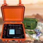
WDJD-4A: Unleashing the Future of Subsurface Imaging For geoscientists and engineers committed to pushing the boundaries of discovery, the WDJD-4A ...
2025-07-22 00:28:12
|
|
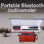
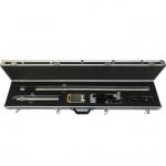
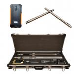
...Magnetic Areas Gyro borehole inclinometer is mainly designed for magnetic mining areas and measuring the inclination (vertex angle) and azimuth of ...
2025-07-22 00:28:12
|
|
5Hz Ultra-Low Power Portable Smart Seismic Node Seismic Instrument Technical Specification Instrument index Parameter index Number of channels 3 ...
2025-03-20 11:34:16
|
|
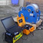
Wireline Multi -Parameter Geophysical Well Logging For Water Well Survey How to use geophysical well logging tool? 1. The instrument should be placed ...
2025-07-22 00:28:12
|
|
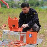
DC Resistivity And Induced Polarization Methods Geophysical Resistivity Survey The WDJD-3A Multi-Function Digital DC Resistivity/IP Meter is an ideal ...
2025-07-22 00:28:12
|
|
...Digital Compass Inclinometer for Well Logging and Geological Survey GDP-3D Wireless Digital Compass Inclinometer is the most recent high-end ...
2025-07-22 00:28:12
|