The Statistical Subsurface Characterization Tool
Modern geotechnical and resource models thrive on quantitative
data—not just visual descriptions but statistically meaningful
measurements that support probabilistic analysis and risk
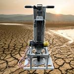
assessment. The GD-C1201 Intelligent Drillhole Optical Imager functions as a statistical characterization tool, enabling engineers and geologists to transform visual
observations into numerical datasets that can be analyzed, averaged, correlated, and used in
stochastic modeling. This system brings statistical rigor to the
borehole, turning each investigation into a source of empirical
distributions rather than anecdotal observations.
Feature Quantification Framework
The software's measurement tools are designed for repeatable, operator-independent quantification. The crack width extraction records perpendicular distances across fractures with 0.1mm
precision, generating a continuous data series of apertures across
the logged interval. The orientation extraction captures strike and dip for each fracture, producing a
dataset that can be plotted on stereonets, clustered into joint
sets, and analyzed for mean orientation and dispersion. The area extraction tool measures void or alteration zone dimensions, providing
areal estimates for volumetric calculations. All measured
parameters are automatically logged into the core attribute sheet, which functions as a structured database—ready for export to
Excel for statistical analysis using built-in functions, pivot
tables, and graphing.
Data Population and Sample Size
Unlike core logging, where only recovered intervals are available
(often less than 70% in fractured ground), the GD-C1201
images 100% of the borehole wall wherever the camera can pass. This complete coverage
dramatically increases the sample size for structural
measurements—a single 100-meter borehole may yield hundreds of
fracture observations, compared to only the recovered pieces.
Larger sample sizes reduce statistical uncertainty, enabling more
reliable estimates of mean fracture spacing, orientation
distribution, and aperture frequency. For projects requiring
probabilistic design (e.g., tunnel support, slope stability), this
data density is indispensable for Monte Carlo simulations and
reliability assessments.
Technical Specifications: The Statistical Engine
Integration with Modeling Software
The exported Excel and CSV files are directly importable into
specialized geostatistical and modeling packages such as Leapfrog,
Datamine, DIPS, and RocData. The system's structured format ensures
that attributes (depth, orientation, aperture, type) are
pre-labeled, eliminating the need for manual reformatting. For
advanced users, the database can be queried to extract specific
subsets—for example, all fractures within a certain depth interval
with apertures exceeding 2mm—for targeted analysis. This seamless
data flow accelerates the model-building process, allowing
engineers to spend more time interpreting and less time preparing
data.
The Quantitative Geologist's Verdict
The GD-C1201 transforms borehole logging from a descriptive art
into a measurement science. It provides the data density and precision needed for robust statistical characterization, enabling
professionals to quantify uncertainty, identify trends, and defend
their models with empirical evidence. By delivering not just images
but measurable, repeatable, and statistically analyzable data, this system aligns with the industry's increasing demand for
evidence-based design and risk-informed decision-making.