
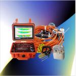
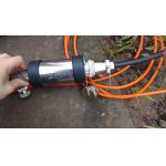
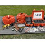
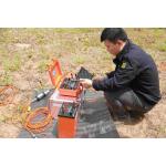
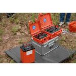
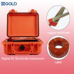
Subsurface Imaging Scanner Geophysical ERT Measurement Instrument Deep Earth Resistivity Mapper

Products Detailed
Subsurface Imaging Scanner Geophysical ERT Measurement Instrument Deep Earth Resistivity MapperNext-Generation Geophysical Imaging with Smart Features Embrace the future of subsurface characterization with this AI-enhanced geophysical platform ... |
| [View Products Detailed] |
| Product Tags: ERT subsurface imaging scanner deep earth resistivity mapper geophysical exploration instrument with warranty |
Related Products

|
Long Battery Life Seismic Refdraction Equipment Transient Multifold Rayleigh Wave Prospectingbuilding Base |

|
Geophysical Sensor Array Seismic Vibrator Truck Core Sample Scanner |

|
Volcanic Observation Magnetometer Environmental Magnetic Sensor Fault Locating Magnetometer |
|
0.02μa Sampling Resolution Dual Electrode Spacing System High Power Transmitter For Mineral Resource Exploration |
|
Resistivity IP Meter Geophysical Exploration Instrument with Digital Accuracy ±1% 900V Processing Power and ±6A Maximum Supply Current |
|
Engineering Seismograph with 50m to 100m Depth 38hz Frequency and 50/40mm Diameter for Geophysical Exploration |
Email to this supplier