
TEM Transient Electromagnetic Geophysical Exploration Instrument For Deep Well Water
|
|
TEM transient electromagnetic Geophysical Survey Equipment for Deep Well Water Exploration
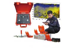
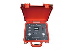
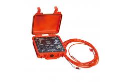
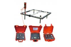
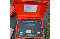
The WTEM (Wireline Transient Electromagnetic) system is a sophisticated geophysical equipment built primarily for subsurface studies. It uses lead synchronization technology to increase the detection range, integrates many functions, and has a portable transmitter. With its wireline design and surface receiver coils, the WTEM system allows for deep penetration and exact data collecting. It is versatile and adaptable to difficult terrains, ensuring rapid data transfer and processing. The WTEM system is a well-known and efficient option for subsurface investigations, having been used extensively in mining, oil and gas exploration, geothermal studies, water resource surveys, and environmental assessments.
Main FeatureLead Synchronization Technology: Offers an extended ultra-high power detection range of up to a thousand meters, enabling efficient exploration of deeper subsurface layers. Integrated Superficial and Intermediate Parts: Combining multiple functions in a single machine, the system is well-suited for complex geological environments like mountainous regions, streamlining operations and enhancing versatility. IGBT Bridge Circuit: Utilizing an IGBT bridge circuit, the system achieves high-power output and quick shut-off, resulting in a portable electromagnetic transmitter that delivers reliable performance. USB Port Data Transfer: The inclusion of a USB port enables seamless data transfer, facilitating easy interaction between the instrument and the user. This enhances usability and simplifies the analysis process. Wide Range of Applications: The system finds broad applications across various investigation tasks, including metal mining, coal fields, oil and gas fields, geothermal exploration, water resource surveys, and environmental pollution detection. This versatility makes it a valuable tool in diverse industries.
ApplicationMineral exploration for locating valuable deposits. Oil and gas exploration to identify hydrocarbon reservoirs. Geothermal exploration for characterizing geothermal resources. Groundwater studies for mapping aquifers and assessing water resources. Environmental assessments for detecting and monitoring pollution. Engineering and geotechnical investigations for evaluating subsurface conditions. Archaeological surveys for locating buried structures and artifacts.
Technical Specification
Product DetailsAbout Us |
||||||||||||||||||||||||||||||||||||||||
| Product Tags: TEM Geophysical Exploration Instrument Deep Well Geophysical Exploration Instrument Transient Electromagnetic Geophysical Exploration Instrument | ||||||||||||||||||||||||||||||||||||||||

|
Drillhole Structural Mapping Tool Subsurface Drillhole Imager |

|
Earthquake Fault Magnetotellurometer Infrastructure Site Magnetotellurometer |

|
Grout Seal Integrity Viewer Packer Setting Confirmation Cam |

|
Grout Seal Integrity Viewer Packer Setting Confirmation Cam |
|
Seismic Source Technology Advanced Seismic Source |

|
Contaminant Plume Imaging Tool Bridge Foundation Survey Meter |