
Geophysical Underground Water Finder Auto Mapping Electronic
|
Detailed Product Description
|
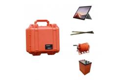
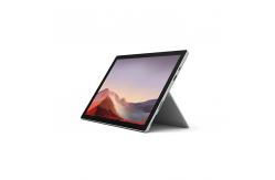
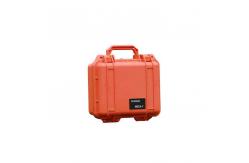
Auto Mapping Geophysical Underground Water Exploration Instrument
What is instrument are used for Underground Water? Geophysical exploration Instrument is widely used in underground water sources, geological structures, mine veins, mine tunnels, cavities, karst caves, ant holes, mined-out areas, dam pipe surge, landslides and other fields.
How to use the geophysical Instrument to get underground water? Geologist use instrument to do geophysical survey in field. They use different instrument to make survey in same place. After get date, use software to analyze and do compare, to find the location and depth of underground water
Specification
Certificate
|
||||||||||||||||||||||||||||||||||||||||||||||
| Product Tags: Geophysical Underground Water Finder Underground Water Finder Auto Mapping | ||||||||||||||||||||||||||||||||||||||||||||||
Related Products

|
Drillhole Structural Mapping Tool Subsurface Drillhole Imager |

|
Earthquake Fault Magnetotellurometer Infrastructure Site Magnetotellurometer |

|
Grout Seal Integrity Viewer Packer Setting Confirmation Cam |

|
Grout Seal Integrity Viewer Packer Setting Confirmation Cam |
|
Seismic Source Technology Advanced Seismic Source |

|
Contaminant Plume Imaging Tool Bridge Foundation Survey Meter |
Email to this supplier