
Custom Geophysical Resistivity Meter For Groundwater ERT Electrical Imaging
|
|
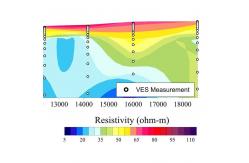
ERT Survey Electrical Imaging Geophysical Resistivity Meters For Groundwater
Introduction:
One of great advantage of electrical resistivity imaging, is that it can be used to image geologic features from tens of feet to several hundred feet in depth, and still maintain excellent resolution, also has an advantage of having a wide range of resistivity values.
Application:
Hydrogeologic assessments using geophysical resistivity meter. Some examples of groundwater problems include aquifer characterization, groundwater exploration, basin delineation, fracture mapping, karst investigations, aquifer storage and recovery monitoring, plume delineation, and investigating groundwater/surface water interactions
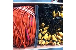
Photo of product
Technical specification
|
||||||||||||||||||||||||||||||||||||||||||||||||||||||||
| Product Tags: Custom Geophysical Resistivity Meter Geophysical Resistivity Meter ERT Custom Resistivity Meter For Groundwater |

|
DZD-8A Multi-Function DC Resistivity Meter & Induced Polarization System for Groundwater Exploration and ERT Surveys |

|
Light Weight ≤4.2Kg Geophysical Resistivity Meter with Methodological Flexibility and Research-Grade Data Transparency |

|
Karst Cavity Detection System Environmental Site Investigation Tool Subsurface Contamination Detector |

|
Field-Deployable High Precision Geophysical Resistivity Meter with Educational Resource Package |
|
Geophysical Resistivity Meter with Depth Range 0~1000 meters Compact Size 270mm×246mm×175mm and Max Voltage 1000V |
|
WDJD-4A Geophysical Resistivity Meter with 0-500m Prospecting Depth and Multi-electrode 2D Resistivity Imaging for High Accuracy Surveys |