
31 - 40 of 93
aerial remote sensing drone
Selling leads
|
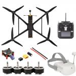
... feed to goggles, a headset, a mobile device, or another display. The user has a first-person view (FPV) of the environment where the drone flies ...
2025-07-29 20:00:45
|
|
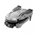
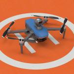
.../GLONASS, the drone is able to accurately locate its position, with a remote control distance of 150m. It is equipped with a two-axis gimbal, ...
2025-03-22 16:25:08
|
|
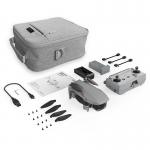
... Lithium Battery, allowing for longer and more efficient flights. The Drone can be controlled either by remote control or mobile phone control, ...
2025-02-14 19:23:16
|

|
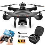
...Aerial Survey Drone This aerial monitoring drone is the perfect choice for any aerial imaging, data collection, and need. Featuring a two axis ...
2025-07-30 00:18:41
|
|
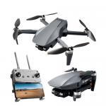
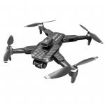
...Aerial Photography Drone is equipped with a 3-axis brushless motor,3km image transmission,5G signal, a flight duration of up to 26 minutes, is it ...
2025-03-22 16:25:18
|
|
Product Description: Aerial Survey Drone is the perfect tool for aerial data collection, aerial imaging and aerial photogrammetry. With maximum ascend ...
2025-02-14 19:23:06
|
|
Product Description: Aerial Photography Uav is an advanced aerial drone and video platform designed for aerial photography, and aerial video creation. ...
2025-03-22 16:25:11
|

|
... Systems like GPS/GLONASS for precise positioning. They have a 3-axis Gimbal and can take high-resolution JPEG photos with an Image Size of 3840...
2025-02-14 19:23:16
|
|
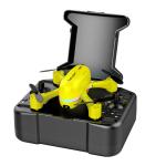
...Drones Obstacle Avoidance Remote Control With Dual Camera Optical Flow UAV With Brushless Motor/Optical flow, ESC camera, IR obstacle avoidance ...
2025-01-26 21:19:01
|
|
...Aerial Photography UAV Professional 3axis Gimbal 4K Camera GPS 5km Control Distance Real-time Transmission Drones 3D Drones are topographical-...
2025-01-26 21:18:50
|