
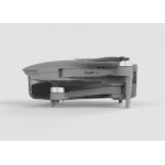
Drones with 4k Camera and Gps Long Range Professional Photography Drone
|
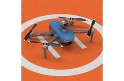
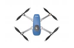
Product Description:Aerial Survey Drone is the perfect tool for aerial data collection, aerial imaging and aerial photogrammetry. With maximum ascend speed of 4m/s and two axis gimbal, it can take crystal clear 1080P images within 10km distance. Moreover, it supports global 4G image transmission, ensuring unlimited distance transmission of images. Its flight time of 40 minutes (no load) and 29 minutes (full load) allows for long and uninterrupted aerial survey and imaging. Features:
Technical Parameters:
Applications:Aerial Survey Drone, with its model number Faith2 SE, is a reliable drone produced in China with a minimum order quantity of 1 pcs. It has a foldable wheelbase and a maximum service ceiling of 4000m above sea level, plus a maximum ascend speed of 4m/s. It is equipped with global 4G image transmission, allowing unlimited distance transmission of 1080P image, with a maximum distance of 10km. It is widely used in aerial photogrammetry and observation, aerial and survey, and is available at a negotiable price. The package can be customized in accordance with the customer's requirement, and the delivery time is within 3-7 work days. The payment terms are flexible, including L/C, D/A, D/P, T/T, Western Union, etc. The supply ability is up to 100,000 pcs per month. Customization:Aerial Survey Drone - Faith2 SE
FAQ:Aerial Survey Drone Q: What is the model number of Aerial Survey Drone? A: The model number of Aerial Survey Drone is Faith2 SE. Q: Where is Aerial Survey Drone from? A: Aerial Survey Drone is from China. Q: What's the minimum order quantity of Aerial Survey Drone? A: The minimum order quantity of Aerial Survey Drone is 1 Pcs. Q: What is the price of Aerial Survey Drone? A: The price of Aerial Survey Drone is Negotiatial. Q: What is the packaging details of Aerial Survey Drone? A: The packaging details of Aerial Survey Drone is Standard Packages. Q: What is the delivery time of Aerial Survey Drone? A: The delivery time of Aerial Survey Drone is 3-7 work days. Q: What are the payment terms of Aerial Survey Drone? A: The payment terms of Aerial Survey Drone are L/C, D/A, D/P, T/T, Western Union. Q: How many Aerial Survey Drone can be supplied per month? A: 100,000 pcs Aerial Survey Drone can be supplied per month.
|
||||||||||||||||||||||||
| Product Tags: Aerial Inspection Drone And 4m/S Professional Photography Drones |

|
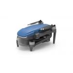
Drone With 4k Camera And Gps 3 Axis Gimbal Professional Drones |
|
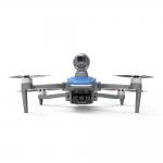
Aerial Photography MINI Drone With 4K Camera 3axis Gimbal UAV Professional GPS 5km Control Distance |
|
Professional Drone with 3-Axis Gimbal 4K Camera Faith2 SE Drones |
|
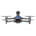
Professional Drone With 4k camera and gps Lidar Obstacle Avoidance Long Range UAV |

|
Professional Photography Drone with 3axis Gimbal 4k Camera and GPS Long Range UAV |
|
Drone 3 Axis Gimbal Professional 4k Camera Aerial Photography Uav Gps Long Range Drones |