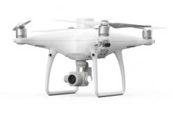
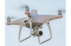
| Aircraft | |
| Weight (including paddle and battery) | 1391 g |
| The wheelbase | 350 mm |
| Maximum take-off altitude | 6000 m |
| Maximum rate of rise | 6 m/s (automatic flight) |
| | 5 m/s (manual control) |
| Maximum rate of descent | 3 m/s |
| Maximum horizontal speed | 50 km/h (positioning mode) |
| | 58 km/h (attitude mode) |
| Maximum tilt Angle | 25° (positioning mode) |
| | 35° (attitude mode) |
| Maximum angular velocity of rotation | 150°/s (attitude mode) |
| Time of flight | About thirty minutes |
| Operating temperature | 0 ℃ and 40 ℃ |
| Working frequency | 2.400ghz to 2.483ghz (Europe, Japan, Korea) |
| | 5.725 GHz to 5.850 GHz (China, USA) |
| Equivalent omni-directional radiated power (EIRP) | 2.4 GHz CE (Europe)/MIC (Japan)/KCC (Korea) : < 20 dBm |
5.8 GHz SRRC (China)/NCC (Taiwan)/FCC (USA) : < 26 dBm |
| Hover precision | When RTK is enabled and RTK works properly: Vertical: ± 0.1m; Level: ± 0.1m |
RTK not enabled: Vertical: ± 0.1m (when visual positioning works normally); ± 0.5m (when GNSS positioning is working normally) Level: ± 0.3m (when visual positioning works normally); ± 1.5m (when GNSS positioning is working normally) |
| Image position compensation | Position of camera center relative to phase center of airborne
d-rtk antenna, body shaft-system :(36, 0, 192) mm, photo EXIF
coordinates have been compensated. The XYZ axis of the body
shafting points to the front, right and bottom of the aircraft
respectively |
| | |
| Figure the functionality | |
| Precision built figure | It can meet the precision requirements of GB/T 7930-2008 1:500
topographic map aerial photogrammetry specification (referred to as
"1:500 specification") ** the actual accuracy is related to many factors such as the
ambient lighting, scene texture, flight height and the mapping
software used. |
| Ground sampling distance (GSD) | (H / 36.5) cm/pixel, H is the flight height of the aircraft relative to the shooting
scene (unit: meters) |
| Collection efficiency | The maximum operating area of a single flight is about 1 km2
(flight altitude is 182 m, that is, GSD is about 5 cm/pixel,
meeting the 1:500 specification requirements) |
| Controllable rotation range | Pitch: -90° to +30° |
| Velocity range | Flight speed ≤ 14m /s (height: 2m, sufficient light) |
| Height range | 0 - 10 m |
| Precise hover range | 0 - 10 m |
| Obstacle sensing range | 0.7 - 30 m |
| Using the environment | The surface has rich texture and sufficient lighting conditions (>15 lux, normal indoor fluorescent lamp irradiation
environment) |
| | |
| The visual system | |
| Velocity range | Flight speed ≤ 50 km/h (height: 2 meters, sufficient light) |
| Height range | 0 - 10 m |
| Precise hover range | 0 - 10 m |
| Obstacle sensing range | 0.7 - 30 m |
| FOV | Front/back: 60° horizontal, ±27° vertical Below: front and rear 70°, left and right 50° |
| Measure the frequency | Front/back: 10 Hz; Lower vision: 20 Hz |
| Using the environment | Rich texture on the surface and sufficient illumination conditions
(>15 lux, normal indoor fluorescent lamp) |
| | |
| The camera | |
| Image sensor | 1 inch CMOS; 20 million effective pixels (20.48 million total
pixels) |
| The lens | FOV 84 °; 8.8mm / 24mm (equivalent format of 35mm); Aperture f/ 2.8-f /11; With autofocus (focus distance 1 m -
infinity) |
| ISO range | Video: 100-3200 (automatic) 100-6400 (manual); Photo: 100-3200 (automatic), 100-12800 (manual) |
| Mechanical shutter | 8 - 1/2000 s |
| Electronic shutter | 8 - 1/8000 s |
| Maximum photo resolution | 4864×3648(4:3);
5472×3648(3:2) |
| Video resolution | H.264,4K:3840×2160 30p |
| Overall design frame | 5640×3710 |
| A valid format | 5472×3648 |
| Video maximum code stream | 100 Mbps |
| Photo format | JPEG |
| Video format | MOV |
| File system support | FAT32(≤ 32 GB);
exFAT(> 32 GB) |
| Support memory card type | MicroSD card with write speed ≥15 MB/s, transmission speed of Class
10 or above or uhs-1 rating, maximum support capacity of 128 GB |
| Operating temperature | 0 ℃ and 40 ℃ |
| Intelligent flight battery (ph4-5870mah -15.2v) | |
| capacity | 5870 mAh |
| voltage | 15.2 V |
| The battery type | LiPo 4S |
| energy | 89.2 Wh |
| Overall battery weight | 468 g |
| Operating temperature | - 10 ℃ and 40 ℃ |
| Maximum charging power | 160 W |
| Intelligent battery for remote control (wb37-4920maa-7.6v) | |
| capacity | 4920 mAh |
| voltage | 7.6 V |
| The battery type | LiPo 2S |
| energy | 37.39 Wh |
| Operating temperature | - 20 ℃ and 40 ℃ |
| | |
| Power adapter (PH4C160) | |
| voltage | 17.4 V |
| Rated power | 160 W |
| | |
| GNSS | |
| Single frequency high sensitivity GNSS | GPS+BeiDou+Galileo (Asian region); GPS+GLONASS+Galileo (other regions) |
| High precision RTK GNSS for multi - frequency multi - system | Use frequency points: GPS: L1 / L2; GLONASS: L1 / L2; BeiDou: B1 / B2; Galileo: E1 / E5 First positioning time: < 50 s Positioning accuracy: 1.5 cm + 1 PPM (RMS) vertically; Level 1 cm + 1 PPM (RMS) 1 PPM means that the error of the aircraft increases by 1 mm for
every 1 km it moves |
| | |
| yuntai | |
| A stable system | 3- axis (pitch, roll, yaw) |
| Controllable rotation range | Pitch: -90° to +30° |
| Maximum control speed | Pitch: 90 ° / s |
| Angular jitter | ±0.02° |
| | |
| Infrared sensing system | |
| Obstacle sensing range | 0.2 - 7 m |
| FOV | The level of 70 ° Vertical plus or minus 10 ° |
| Measure the frequency | 10 Hz |
| Using the environment | The surface is diffuse with a reflectance of > 8% (e.g. walls,
trees, people, etc.) |
| | |
| The remote control | |
| Working frequency | 2.400ghz to 2.483ghz (Europe, Japan, Korea) 5.725 GHz to 5.850 GHz (China, USA) |
| Equivalent omni-directional radiated power (EIRP) | 2.4 GHz
CE / MIC / KCC:< 20 dBm 5.8 GHz
SRRC / FCC:< 26 dBm |
| Signal maximum effective distance | FCC: 7 km; SRRC/CE/MIC/KCC: 5 km (no interference, no shielding) |
| power | 16w (typical value) |
| Display device | 5.5-inch screen, 1920×1080 resolution, 1000 CD /m2 brightness,
Android Memory 4G RAM+16G ROM |
| Operating temperature | 0 ℃ and 40 ℃ |
| PHANTOM 4 CHARING HUB | |
| voltage | 17.5 V |
| Operating temperature | 5 ℃ to 40 ℃ |
| | |
| Smart battery charging butler (WCH2) | |
| The input voltage | 17.3 - 26.2 V |
| Output voltage current | 8.7 V,6 A;
5 V,2 A |
| Operating temperature | 5 ℃ to 40 ℃ |
| | |
| The SDK remote control | |
| Working frequency | 2.400ghz to 2.483ghz (Europe, Japan, Korea) 5.725 GHz to 5.850 GHz (other countries and regions) |
| Equivalent omni-directional radiated power (EIRP) | 2.4 GHz
CE / MIC / KCC: < 20 dBm
5.8 GHz
FCC / SRRC / NCC: < 26 dBm |
| Signal maximum effective distance | FCC/NCC: 7 km; CE/MIC/KCC/SRRC: 5 km (no interference, no shielding) |
| Built-in battery | 6000 mAh 2S lithium rechargeable battery |
| Working current/voltage | 1.2 A @ 7.4 V |
| Mobile support | It works on tablets or phones |
| Operating temperature | 0 ° to 40 ° C |