
41 - 50 of 56
hesai sensor uav lidar system
Selling leads

|
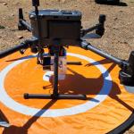
...LiDAR Scanning System Geosun GS-130X Colored Point Cloud High Accuracy Geosun gAirHawk Series GS-130X Drone LiDAR Scanning System Drone LiDAR ...
2025-07-29 00:11:05
|
|
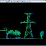
...LiDAR Mapping 3D Scanning Accuractely Capture Demonstration In Australia Geosun gAirHawk Series Drone LiDAR Scanning System GS-130X Drone LiDAR ...
2025-07-29 00:11:05
|
|
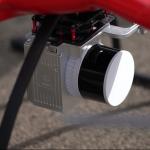
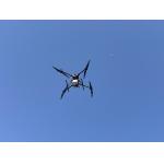
... UAV LiDAR Surveying Geosun Partner In Indian Multi-Rotor Support High Precision Geosun gAirHawk Series GS-260X uav LiDAR Scanning System gAirHawk ...
2025-07-29 00:11:05
|
|
... GS-260H UAV LiDAR Aerial Mapping Drone Surveying City Construction 3D Modeling Geosun gAirHawk LiDAR Scanning System GS-260H gAirHawk GS-260X is a ...
2025-07-29 00:11:05
|
|
... LiDAR point cloud data acquisition system, integrated HESAI XT laser scanner, GNSS and IMU positioning and attitude determination system, and ...
2025-07-25 11:54:18
|
|
GS-260F RTK Model Drone LiDAR Scanner HESAI Pandar40P Multi Platform Free Trajectory Processing Geosun gAirHawk Series Drone LiDAR Scanning System GS...
2025-07-25 11:55:45
|
|
...LiDAR Scanning System HESAI XT16 Slam Algorithms Under Ground Mapping 3D Data Collection Geosun gFireEye Series GS-100G SLAM LiDAR Scanning System ...
2025-07-29 00:11:05
|
|
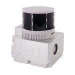
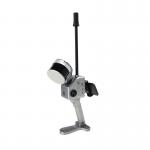
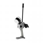
...LiDAR HESAI XT32 Slam Algorithms Indoor Outdoor Mapping 3D Data Collection Geosun gFireEye Series GS-130G SLAM LiDAR GS-130G is a kind of handheld ...
2025-07-29 00:11:05
|

|
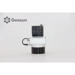
...HESAI XT32 Slam Algorithms Indoor/Outdoor Mapping 3D Data Collection Geosun gFireEye Series GS-120G SLAM LiDAR GS-120G is a kind of handheld LiDAR ...
2025-07-29 00:11:05
|
|
... GS-260F UAV LIDAR SCANNING SYSTEM Drone LiDAR Scanning System Application for Mapping and Survey GS 260F Mobile LiDAR System - YouTube gAirHawk GS...
2025-07-29 00:11:05
|