
21 - 23 of 23
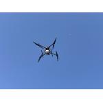
aerial survey operation lidar drone
Selling leads
|
gAirHawk GS-260F UAV LIDAR SCANNING SYSTEM Drone LiDAR Scanning System Application for Mapping and Survey GS 260F Mobile LiDAR System - YouTube ...
2025-07-28 00:13:17
|
|
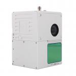
... gAirHawk GS-100C+ is a kind of light compact LiDAR point cloud data acquisition system, integrated Livox new generation laser scanner, GNSS and ...
2025-07-28 00:13:17
|
|
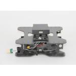
Mounting Kits for DJI M210, M300, M600 Pro and other brands. DJI drones are good application for survey & mapping, especially for DJI M210, M300 and ...
2025-07-25 11:53:58
|