
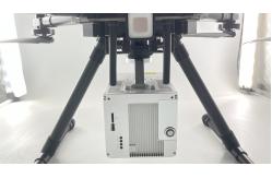
Geosun GS-100C Skyport 100m AGL Integrated Livox Avia UAV LiDAR System
|
|
Geosun GS-100C Skyport 100m AGL Integrated Livox Avia UAV LiDAR System
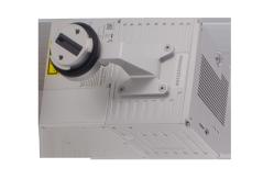
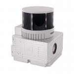
Geosun gAirHawk Series GS-100C LiDAR Scanning System
Specification of Geosun gAirHawk Series GS-100C LiDAR Scanning System
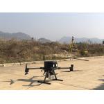
Application of Geosun gAirHawk Series GS-100C LiDAR Scanning System
Package of Geosun gAirHawk Series GS-100C LiDAR Scanning System Geosun gAirHawk Series GS-100C LiDAR Scanning System is packed by suit case with EVA material liner inside, then covered by hard carton box. It is suitable for air shipment and sea shipment.
|
|||||||||||||||||||||||||||||||||||||||||||||||||||||||||||||||||
| Product Tags: 100m AGL UAV LiDAR System | |||||||||||||||||||||||||||||||||||||||||||||||||||||||||||||||||

|
Terrain Mapping Aerial Surveying Geosun UAV LiDAR System GS-130X High Precision |

|
GS-100V UAV LiDAR System 360 Degree Fov Laser Sensor Colored Point Cloud Free Software |
|
AirPort Construction UAV LiDAR GS-260X High End Pos Built In RGB Camera |

|
GAirHawk Series GS-2000N LiDAR Scanning System Long Detection Airborne Mapping |
|
Geosun GAirHawk Series GS-260X UAV LiDAR Scanning System HESAI XTM2X Sensor |
|
Terrain Mapping GS-260X UAV LiDAR Scanning System HESAI Sensor |