
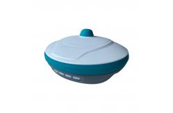
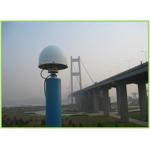
BASE/ROVER STATION
|
|
RTK Instrument Surveying & Mapping Instruments GPS Receiver Gain a competitive edge with the Easynavtech R7GNSS Receiver.
The R7 is equipped with advanced technology to make sure you
havemaximum productivity in the field. The durable IP67 design
makes it possible to work in tough environments. Combining 4G
GSM modem,internal radio (Rx only), RTK Aid function and
60°inclination IMU function, the R7 is the best choice for a
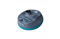
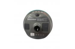
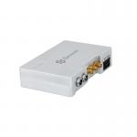
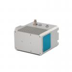
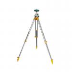
rover station receiver. Lightweight Design: Easy to Carry Easily carry it in various complex environments and use it in any rover station scenarios, benefitting from its lightweight and compact design. Web UI It allows users to view position status, set up working mode, download data, and update firmware from the Web user interface with any smartphone, tablet, or PC. Integrated RX Radio The built -in Global 4G Network and RX radio module allows the E200
to work perfectly as a rover station. Max 60° Tilt Survey: A Different Way of Working Quickly measure accurate points while standing or walking without leveling the pole. Concentrate on where the pole tip needs to go, which is especially useful during a stakeout. E a s i l y s t a r t a s u r v e y i n environments that are
hard to reach, such as building corners and slopes. No longer worry
about the move ment o f the pol e when measuring, provided
that the pole tip is stationary. RTK Aid Function: Uninterrupted Work Work without interruption even when RTK corrections fail, powered by our RTK aid function. Multi-constellations and Multi-frequency With 1408 channels of GNSS tracking, the R7 provides stable and reliable accuracy . All GNSS signals can be tracked, including GPS, BDS, GLONASS, GALILEO and QZSS.
|
||||||||||||||||||||||||||||||||||||||||||||||||||||||||||||||||||||||||||||||||||||||||||||||||||||||||||||||||||||||||||||||||||||||||||||||||||||||||
| Product Tags: GPS Receiver RTK solution 2G Byte RTK Instrument 2G Byte RTK solution | ||||||||||||||||||||||||||||||||||||||||||||||||||||||||||||||||||||||||||||||||||||||||||||||||||||||||||||||||||||||||||||||||||||||||||||||||||||||||
|
Photography Surveying PPK Solution Aerial GNSS Receiver |
|
GPS BDS GLONASS GNSS INS System For Positioning And Altitude |
|
Integrated Laser Sensors Velocity Measurement GNSS INS System |

|
Photography Surveying Kinematic differential Positioning PPK Solution |
|
1mm Accuracy GNSS Deformation Monitoring System |
|
Base & Rover station receiver |