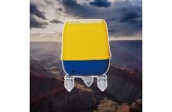
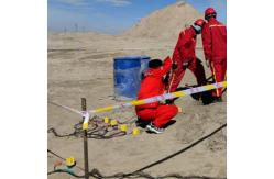
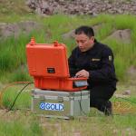
3C Seismic Sensor with GPS Autonomous Seismic Recorder
Verifying Ground Conditions Before Concrete is Poured
Construction projects fail or succeed based on what lies beneath
the surface. The GD-3C Nodal Seismometer serves as a construction quality guardian, providing non-destructive, high-resolution imaging of soil and rock conditions before foundations are poured, tunnels
are bored, or embankments are built. By delivering quantitative, verifiable data about subsurface stiffness, layering, and anomalies, it enables
engineers to validate designs, identify hazards, and avoid costly change orders.
Shear Wave Velocity Profiling for Foundation Design
The most critical parameter for seismic site response and
foundation settlement is shear wave velocity (Vs). Traditional methods—downhole and crosshole testing—provide
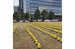
excellent data but at high cost and only at sparse points. The GD-3C enables surface wave methods (MASW, ReMi) that deliver continuous Vs profiles along entire alignments. Deploying a linear array of nodes along a
proposed building footprint or transportation corridor,
geotechnical engineers can generate high-resolution Vs30 and Vs100 maps that reveal soft zones, stiff layers, and lateral variations. This
data directly informs shallow foundation design, pile depth requirements, and seismic
site class assignments, eliminating guesswork and reducing contingency factors.
Detecting Hidden Hazards Before Excavation
Voids, boulders, buried channels, and old foundations are unwelcome surprises that derail construction schedules and budgets. The GD-3C, used in
refraction microtremor (ReMi) or multichannel analysis, can image these features with meter-scale resolution before excavation begins. A void might appear as a low-velocity
anomaly; a large boulder as a high-velocity lens. Identifying these
features in the design phase allows engineers to relocate foundations, adjust boring plans, or pre-condition the
ground, avoiding the costly delays and claims that arise when excavators hit the unexpected.
Construction Quality Specifications
| Parameter | Geotechnical Site Investigation Standard | Engineering Benefit |
|---|
| Depth of Investigation | 30-50 meters for typical soil profiles | Covers the active zone for most shallow foundations |
| Vertical Resolution | 1-2 meters in upper 30 meters | Resolves thin soft layers that control settlement |
| Lateral Resolution | 5-10 meters with typical receiver spacing | Maps lateral variations in foundation conditions |
| Vs Accuracy | ±5% compared to downhole methods | Provides confidence for design without over-conservatism |
| Deployment Speed | 1 km of linear profile per hour | Enables full site characterization in days, not weeks |
| Immediate Feedback | Onboard processing shows Vs profile in field | Allows survey adjustments and target investigation on the spot |