
Magnetic Anomaly Drone Drone Total Field Magnetometer UAV Magnetic Gradiometer
|
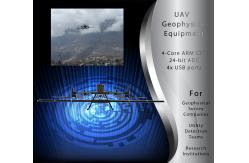
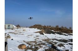

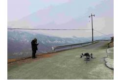
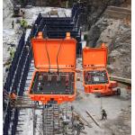
What Is the GD350 UAV Magnetic Survey System?If you work in geophysics, mining, or utility detection, you know how important accurate magnetic surveys are. Unlike traditional ground surveys (which are slow and labor-intensive), this system attaches to a DJI M300 RTK drone, letting you cover large areas quickly while collecting high-resolution magnetic data.
How Does It Work?The system uses two advanced sensors:
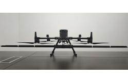
These sensors are mounted on a carbon fiber pole, keeping them 1.5 meters away from the drone’s electronics to avoid interference. The Data Acquisition Module (DAQ) processes readings in real time, correcting for drone-induced magnetic noise, and sends data wirelessly (10Hz update rate) to a ground station.
Key Benefits for Professionals✔ Lightweight & Portable (1.5 kg) – Easy to carry and install on a DJI M300 RTK.
Who Can Use This System?
Technical BreakdownOPM Magnetometer
Fluxgate Magnetometer
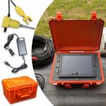
Data Acquisition Module (DAQ)
Compatible with DJI M300 RTK
Why This System Beats Traditional Methods Faster Surveys – Drones cover 10x more area per hour than ground crews.
|
| Product Tags: UAV Magnetic Anomaly Drone UAV Magnetic Gradiometer Total Field Magnetometer Drone |

|
Long Battery Life Seismic Refdraction Equipment Transient Multifold Rayleigh Wave Prospectingbuilding Base |

|
Geophysical Sensor Array Seismic Vibrator Truck Core Sample Scanner |

|
Volcanic Observation Magnetometer Environmental Magnetic Sensor Fault Locating Magnetometer |

|
0.02μa Sampling Resolution Dual Electrode Spacing System High Power Transmitter For Mineral Resource Exploration |
|
Resistivity IP Meter Geophysical Exploration Instrument with Digital Accuracy ±1% 900V Processing Power and ±6A Maximum Supply Current |
|
Engineering Seismograph with 50m to 100m Depth 38hz Frequency and 50/40mm Diameter for Geophysical Exploration |