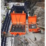
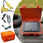
High Resolution Optical Televiewer Full Hole Imaging System
|
|
GD-C1201 Full Hole Wall Imaging System Product Description: GD-C1201 Intelligent Borehole Optical Imager is an innovative, high-quality advanced product. At present, this high-tech imager has abandoned the traditional system structure mode of video acquisition card, controller, laptop, probe, and manual editing mode of profile, and replaced it with the most advanced DSP image acquisition and processing technology. In addition, this imager has high integration, panoramic shooting probe, real-time automatic extraction of profile, clear and realistic images, automatic and accurate calibration of direction and depth, and can perform all-round and full-cylindrical observation and imaging of various observation holes (vertical holes, horizontal holes, inclined holes, depressions or elevation holes). It is no exaggeration to say that GD-C1201 Intelligent Borehole Optical Imager is one of the most advanced in-hole imaging systems in the industry!
Specification:
Imaging effect: Main Features: ♦Highly integrated ♦Easy expansion ♦High intelligent ♦High reliability ♦High definition ♦Wide visual angle ♦Good portability ♦Good operating performance ♦Low requirement on power source
Packing&Shipping:
About us:
Contact us: |
||||||||||||||||
| Product Tags: Full Hole Imaging System Optical Televiewer High Resolution Optical Televiewer Full Hole Imaging System |

|
Long Battery Life Seismic Refdraction Equipment Transient Multifold Rayleigh Wave Prospectingbuilding Base |

|
Geophysical Sensor Array Seismic Vibrator Truck Core Sample Scanner |

|
Volcanic Observation Magnetometer Environmental Magnetic Sensor Fault Locating Magnetometer |

|
0.02μa Sampling Resolution Dual Electrode Spacing System High Power Transmitter For Mineral Resource Exploration |

|
Resistivity IP Meter Geophysical Exploration Instrument with Digital Accuracy ±1% 900V Processing Power and ±6A Maximum Supply Current |

|
Engineering Seismograph with 50m to 100m Depth 38hz Frequency and 50/40mm Diameter for Geophysical Exploration |


