
Terrameter Geophysical Survey Equipment Multifunction Resistivity Meter
|

|
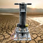
Multi- function Terrameter Geophysical Survey Equipment
Introduction
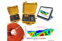
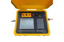
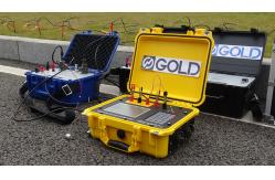
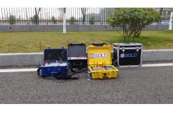
This geophysical survey equipment is multifunction, it will measure various parameter such as voltage, current, apparent resistivity, apparent polarizability, natural potential, self electric gradient, half decay, attenuation, excitation ratio, deviation, metal factor, ground resistance and voltage decay curve. The geophysical equipment with Intelligent control,the curves and data will display in screen on real time. It will work for 1D VES (Vertical Electrical Sounding), 2D Electrical Resistivity tomograph and 3D IP imaging. The Geophysical Equipment will work together with resistivity cable, electrode, software. 2 person work together, one is operate instrument, and another for cable array.
Usage
The survey instrument as following : Seismic Surveys. ... Ground-Penetrating Radar. ... Magnetic Surveys. ... Radiometric Surveys. ... Gravity Surveys. ... Induced Polarity (IP) Surveys. ... Electromagnetic (EM) Surveys. ... Down Hole Surveys.
Specification
Certificate
About Us |
||||||||||||||||||||||||||
| Product Tags: Terrameter Geophysical Survey Equipment Geophysical Survey Equipment Multifunction |

|
Drillhole Structural Mapping Tool Subsurface Drillhole Imager |

|
Earthquake Fault Magnetotellurometer Infrastructure Site Magnetotellurometer |

|
Grout Seal Integrity Viewer Packer Setting Confirmation Cam |

|
Grout Seal Integrity Viewer Packer Setting Confirmation Cam |
|
Seismic Source Technology Advanced Seismic Source |

|
Contaminant Plume Imaging Tool Bridge Foundation Survey Meter |