
31 - 40 of 65
gps load bearing drone
Selling leads
|
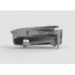
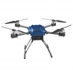
... that offers users a maximum distance of 1080P 10km. It features a foldable wheelbase of 600mm and is equipped with GPS/GLONASS satellite ...
2025-08-01 00:18:57
|
|
... and , providing users with a wealth of geographical information for a variety of applications. These drones are equipped with advanced features ...
2025-01-26 21:18:52
|
|
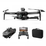
... x 34 x 7cm(expanded size) 18*12.5*7cm(folded size) Product name 5G brushless Flow Obstacle avoidance GPS aerial photography drone Fuselage Color ...
2025-02-17 21:27:56
|

|
... who need to inspect infrastructure from a distance. This drone features a chart pass distance of up to 30 meters, a foldable wheelbase for easy ...
2025-01-26 21:18:40
|
|
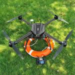
Product Description Obstacle Avoidance Aerial Survey Drone With Lidar For Police Application And Detection Drone With Lidar This 540-degree rotating ...
2025-08-01 00:18:57
|
|
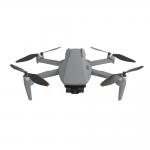
...Drone experience. It has a wheelbase of 600mm, which is foldable, and a maximum speed of 17m/s. Moreover, it has a maximum ascend speed of 5m/s, ...
2025-08-01 00:18:56
|
|
...Drone is a radio-controlled aircraft that can be remotely operated. It is a lightweight, foldable drone with a Take Off Weight of about 3178g and a ...
2025-08-01 00:18:57
|
|
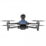
... drone features a maximum speed of 17m/s, satellite positioning systems such as GPS/GLONASS, a 3000mAh battery, maximum decsend speed of 3m/s, and ...
2025-02-17 21:27:59
|
|
...Drone is an Autonomous Aerial System, a revolutionary Airborne Drone, providing a comprehensive Robotic Aerial System. It is equipped with a 3-axis ...
2025-08-01 00:18:57
|

|
Product Description: Aerial Survey Drone This aerial monitoring drone is the perfect choice for any aerial imaging, data collection, and need. ...
2025-08-01 00:18:57
|