
21 - 30 of 31
gps fpv uav plane
Selling leads
|
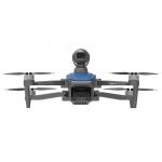
... battery, 1080P resolution up to 10km, and an impressive flight time of 40 minutes (no Load) and 29 minutes (full Load). Equipped with GPS/GLONASS ...
2025-08-03 00:17:25
|
|
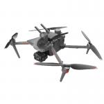
...Satellite Positioning Systems like GPS/GLONASS for precise positioning. They have a 3-axis Gimbal and can take high-resolution JPEG photos with an ...
2025-02-14 19:23:16
|
|
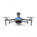
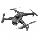
Product Description 4k Hd Aerial Photography Camera Drone With Lidar Obstacle Avoidance Rc Drones This lidar camera RC drone is a professional aerial ...
2025-08-03 00:17:25
|
|
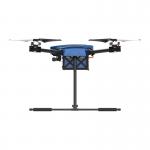
5000m Max Service Ceiling Above Sea Level Industrial Grade Drone - 3840*2160 Image Size Product Description: Introducing Industrial Grade Drone, a ...
2025-08-03 00:17:25
|

|
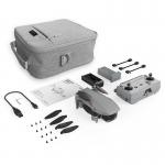
HD Camera Drone With Remote Control For Taking Video Production Product Specification 1 Aircraft HD Camera Drone Size Unfold: 165 X 188 X 59 mm ( L*W...
2025-03-22 16:25:02
|

|
Product Description: 3D Drones are Unmanned Aerial Vehicles (UAVs) used for Geographic Information System (GIS) and purposes. These high-performance ...
2025-02-17 21:28:00
|
|
Product Description: Aerial Exploration Drone - The Ultimate Aerial Drone The Aerial Exploration Drone is the best and most advanced aerial drone on ...
2025-08-03 00:17:25
|

|
Product Description: Aerial Survey Drone This aerial monitoring drone is the perfect choice for any aerial imaging, data collection, and need. ...
2025-08-03 00:17:25
|
|
Product Description More and more accidents happen, for example, the Ocean Titan disaster where 5 people including a billionaire on board died. Also, ...
2025-08-03 00:17:25
|
|
...Uav is an advanced aerial drone and video platform designed for aerial photography, and aerial video creation. This powerful unmanned aerial ...
2025-03-22 16:25:11
|