
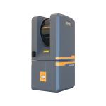
W30 Easyscan User Friendly LiDAR Solution For All Skill Levels
|


|
Easyscan W30: User-Friendly LiDAR Solution for All Skill
Levels
Features Ultra long endurance the innovative design of the system makes the whole scanner smaller in size and only 960g in weight, which can effectively extend the flight time in the air.
Ultra-high precision with the unique intelligent algorithm, the massive 3D point cloud obtained can achieve professional-level measurement accuracy.
Extremely integrated seamless compatible with DJI M300 RTK, the system is designed for unprofessional users, through simple plug and play, the user can control and monitor the whole system by using integrated Apps in DJI’s control unit; the data is well organized to be stored, with a simple one -click, the data can be downloaded locally.
Real-time monitoring transmitted back and displayed in DJI’s control unit in order to help the user to evaluate the system in the air in real time. Applications
Accessories Case Sample Data Display
|
||||||||||||||||||||||||||||||||||||||||||||||||||||||||||||||
| Product Tags: W30 easyscan 905nm easyscan 150m LiDAR Solution |

|
Super Light Weight Handheld SLAM 3D LiDAR Scanner EasyScan M05 |

|
HESAI Sensor XT16 Terrestrial 3D Laser Scanner EasyScan T05 |

|
Fixed 3D LiDAR Scanner Terrestrial EasyScan T05 3 Embedded Cameras |

|
3D Tls Terrestrial Laser Scanner Easy Scan T05 For Ancient Building Modeling |
|
3 Embedded Cameras Terrestrial Lidar Scanner 3D Scanning Class I |

|
W30 Easyscan User Friendly LiDAR Solution For All Skill Levels |