
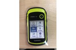
Cheaper Price Easy Operate Garmin Etrex 10 Worldwide Handheld GPS Quality
|
|
Product Description Cheaper price easy operate Garmin Etrex 10 Worldwide Handheld GPS quality
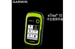
Garmin eTrex 10 handheld GPS
eTrex 10 retains the core functionality, rugged construction, affordability and long battery life that made eTrex the most dependable GPS device available. We improved the user interface and added a worldwide basemap, paperless geocaching and support for spine-mounting accessories. See the WayeTrex 10 has an enhanced 2.2" monochrome display that’s easy to read in any lighting situation. Both durable and water resistant, eTrex 10 is built to withstand the elements. Its easy-to-use interface means you’ll spend more time enjoying the outdoors and less time searching for information. eTrex 10 features the legendary toughness that’s built to withstand the elements. Dust, dirt, humidity, water — none are a match for this navigator. Find FuneTrex 10 supports geocaching GPX files for transferring geocaches. Visit OpenCaching to start your geocaching adventure. By going paperless, you're not only helping the environment but also improving efficiency. eTrex 10 stores and displays key information, including location, terrain, difficulty, hints and descriptions, which means no more manually entering coordinates and paper printouts. Simply upload the GPX file to your eTrex 10 and start hunting for caches. Keep Your FixWith its high-sensitivity, WAAS-enabled GPS receiver and HotFix® satellite prediction, eTrex 10 locates your position quickly and precisely and maintains its GPS location even in heavy cover and deep canyons. Whether you’re in deep woods or just near tall buildings and trees, you can count on eTrex 10 to help you find your way when you need it the most. Go GlobaleTrex devices are the first-ever consumer-grade receivers that can track both GPS and GLONASS satellites simultaneously. When using GLONASS satellites, the time it takes for the receiver to “lock on” to a position is (on average) approximately 20 percent faster than using GPS. And when using both GPS and GLONASS, the receiver has the ability to lock on to 24 more satellites than using GPS alone. Plan Your Next TripTake charge of your next adventure with BaseCamp™, software that lets you view and organize maps, waypoints, routes, and tracks. This free trip-planning software even allows you to create Garmin Adventures that you can share with friends, family or fellow explorers. BaseCamp displays topographic map data in 2-D or 3-D on your computer screen, including contour lines and elevation profiles.
Packaging & Shipping
Our Services 1. Warranty: 12 months warranty is offered for survey equipment. 6
months warranty offered for survey accessory. Warranty comes in
effective from the day your receive good.
Company Information Shanghai Galxy International Trade company, Ltd. combining with
developing, researching and producing. Our company is located in
Pudong Developing Zone, and has two subsidiary companies: Shanghai
Galaxy International Trade Co., Ltd. and Mato Opto-electrical
High-tech Company. Our company has researching center and factory
in Changzhou. FAQ 1.What kind payment method we accept?
Contact Us
Shanghai Galaxy International Trade CO.,Ltd TELL: +86-18017639312 Contact person :Lydia Zhu |
||||||||||||||||||||||||||||||||||||||||||||||||
| Product Tags: Land Survey GPS Receiver Etrex 10 RTK GPS Receiver Transflective Display GPS Navigator | ||||||||||||||||||||||||||||||||||||||||||||||||
|
Survey Rtk gnss receiver CHC E91 with intelligent 10200 mAh battery work up to 16 hours |
|
South Land Surveying Measuring Instrument RTK 0° ~ 60° IMU tilt angle GPS South Galaxy G3 |

|
Linux Controller South Galaxy G3 RTK 1598 Channels South G3 GNSS GPS Receiver |
|
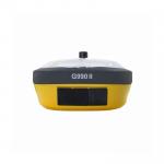
IP68 Unistrong G990II ( E800 ) Land Surveying Instrument G990II Antenna IMU RTK Price |
|
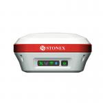
Dual Frequency GNSS Rover Receiver 800 Channels GPS RTK Stonex S3IISE |
|
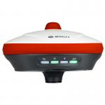
High Accuracy IP68 GPS Stonex S900 / S1 Handheld Rover RTK GNSS S1 |