
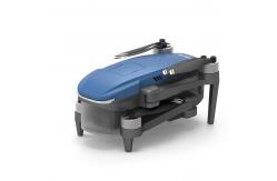
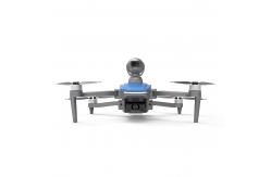
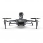
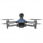
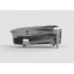
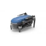
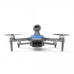
Faith2 SE Aerial Survey Drone Foldable Remote Control Drone With Camera
|
Detailed Product Description
|
Specification
Description
Aerial Survey Drone, also known as an UAV (Unmanned Aerial Vehicle) or UAS (Unmanned Aerial System) for aerial , is an unmanned aircraft equipped with specialized sensors and cameras used to capture high-resolution imagery and data from an aerial perspective for and applications. These drones are specifically designed for conducting surveys and collecting geospatial information efficiently and accurately.
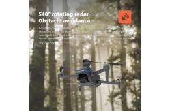
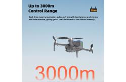
Features
Applications
|
||||||||||||||||||||||||||||||||||||||||||||||||||||||||||||||||||||||||||||||||||||||||||||||||||||||||||||||||||||||||||||||||||||||||||||||||||||||||||||
| Product Tags: Faith2 SE Aerial Survey Drone Aerial Survey Drone Foldable Remote Control Drone With Camera |
Related Products
|
Enterprise UAV Professional 3 Axis Gimbal 4K Video Camera Commercial Drone |
|
Drone With 4k Camera And Gps 3 Axis Gimbal Professional Drones |
|
Aerial Photography MINI Drone With 4K Camera 3axis Gimbal UAV Professional GPS 5km Control Distance |
|
Professional Drone with 3-Axis Gimbal 4K Camera Faith2 SE Drones |
|
Professional Drone With 4k camera and gps Lidar Obstacle Avoidance Long Range UAV |

|
Professional Photography Drone with 3axis Gimbal 4k Camera and GPS Long Range UAV |
Email to this supplier